 Politics
Politics
Politics  Humans
 10 Extraordinary Places Humans Have Adapted to Live
 Weird Stuff
 Ten of the Strangest Things You Can Buy Online
 Movies and TV
 10 Crime Shows with Gorgeous Settings
 History
 10 Cold War Spies Who Feared Nothing
 Animals
 10 of the Most Gluttonous Animals
 Music
Music 10 Women Who Changed Rock and Metal Forever
 Misconceptions
 10 Things That Exist (But Not in the Way You Think)
 Movies and TV
 10 Film Franchises That Never Fixed Their Biggest Problems
 Technology
 10 of History’s Most Expensive Megaprojects
Politics 10 Strange High-Tech Tools Shaping Modern Politics
Humans 10 Extraordinary Places Humans Have Adapted to Live
Weird Stuff Ten of the Strangest Things You Can Buy Online
Who's Behind Listverse?

Jamie Frater
Head Editor
Jamie founded Listverse due to an insatiable desire to share fascinating, obscure, and bizarre facts. He has been a guest speaker on numerous national radio and television stations and is a five time published author.
More About Us
Movies and TV 10 Crime Shows with Gorgeous Settings
History 10 Cold War Spies Who Feared Nothing
Animals 10 of the Most Gluttonous Animals
Music 10 Women Who Changed Rock and Metal Forever
Misconceptions 10 Things That Exist (But Not in the Way You Think)
Movies and TV 10 Film Franchises That Never Fixed Their Biggest Problems
Technology 10 of History’s Most Expensive Megaprojects
10 Monumental Map Blunders And Lies
Undoubtedly, we’ve all gone on a wild goose chase or driven around in circles while trying to follow a faulty map. While annoying, these experiences don’t make history. The map mishaps below, however, have taken on a life of their own, influencing monumental events or otherwise causing a major stink.
10Agloe, New York
To protect their work from copyright infringement, it’s not uncommon for cartographers to put fake locations or landmarks—known as paper towns, trap streets, or Mountweazels—on their maps. If the inventor of such a place sees it on someone else’s map, they know their work was ripped off. Most of these copyright traps go unnoticed by the general public, but occasionally, these fictitious places take on a life of their own. Such is the case of Agloe, New York.
Otto G. Lindberg and Ernest Alpers of General Drafting created the fake town of “Agloe” (a combination of the first letters of their names) in the 1930s and positioned it in the Western Catskills on their maps of New York. A short time later, they noticed that their invented town was also listed on Rand McNally’s maps, spurring Lindberg to sue the company. However, in a surprising ruling, McNally was judged innocent.
How could Lindberg and Alpers lose the case when Agloe was clearly their creation? It turned out that, in the exact spot where the imaginary Agloe was supposed to be, someone who had seen General Drafting’s maps had built an “Agloe General Store.” Rand McNally’s winning argument was that the store’s existence proved Agloe’s legitimacy.
From there, Agloe became as real as a town can get without actually being real. It was described in travelogues, appeared in printed maps for over 90 years, made it onto Google Maps (but was removed in early 2014), and is on the verge of having a historic sign put up in its honor.
9The Mountains Of Kong, Africa
A variety of 19th-century explorers—such as Rene Caillie, Richard Lemon Lander, and Hugh Clapperton—went on daring expeditions to the Mountains of Kong in search of its gold, riches, and access to the west coast of Africa. These explorers described their journeys in detail, and the great mountain range was printed in 40 maps over the course of nearly 100 years. The only problem was that the Mountains of Kong were a complete lie.
It’s unusual that so many unrelated explorers would contribute to such a tale, but perhaps none wanted to admit to each other—or the world—that they couldn’t find such a massive landmark. As such, the myth carried on until about the 1890s, when enough notable explorers verified the Mountains were not there. Still, the Mountains of Kong didn’t want to go down without a fight. They somehow reappeared in respected atlases in 1928 and 1995.
8Every Soviet Map Published From 1938–1988
In 1988, the Soviet Union admitted that, for the previous 50 years, all of their maps had been faked. They fabricated the position or existence of streets, rivers, boundaries, and most other types of geographical features. The aim of this cartographic propaganda was to prevent aerial bombing and foreign intelligence.
These maps woefully confused their own citizens and tourists, and they proved rather effective against the enemy. During World War II, Germans under the command of General Gunther Blumentritt attempted to invade the Soviet Union but discovered that their maps “in no way corresponded with reality.” Where they expected countryside, they found large cities, and where they hoped to find roads, they stumbled across sand. Eventually, the troops had wandered so far off the beaten path that it only took a few hours of rain for all of their transport vehicles to get stuck in the mud.
7New South Greenland
Benjamin Morrell “discovered” this imaginary land during an 1823 sealing and exploration voyage. New South Greenland supposedly stretched for at least 644 kilometers (400 mi) just off the Antarctic Peninsula. Because so little was known about the area at the time, many folks just accepted the reality of this place as fact and included it on an assortment of maps.
Morrell wrote in detail about his journey to this land, provided specific coordinates for it, and even described its mountainous appearance. Some of his more enlightened contemporaries were skeptical of his findings, though, especially since he seemingly traversed the dangerous and icy Antarctic seas so quickly and without incident. Also, he made no mention of New South Greenland being covered in ice, which seemed odd, since that’s the main feature of every other landmass in the vicinity. Those anomalies, along with his general reputation for being an exaggerator, earned him the nickname of “the biggest liar in the Southern Ocean.”
Even so, New South Greenland remained on maps until around 1915. Although there are many theories as to what Morrell actually did or did not see, it’s still not clear whether he was an unashamed liar or simply a totally inept navigator.
6The Northwest Passage
Perhaps any of us would have hallucinations if we spent endless days at sea eating rats and hoping for wind, but Giovanni da Verrazano was yet another explorer who confidently declared the existence of something that just wasn’t real. In 1524, he was commissioned by the French government to find the elusive “Northwest Passage” to Asia. He ended up sailing into what is now known as the Carolina coast of the United States, and after seeing what was likely the Pamlico Sound, he presumptuously proclaimed to have reached the Pacific Ocean. Evidently, no other fact-checking was required. Verazzano took his exciting news back to France, and maps featuring this imaginary passage to the Pacific spread throughout Europe.
Verazzano’s mistake had far more influential consequences than just the creation of some faulty maps. His “findings” were one of the primary reasons Europeans sought to settle in North America in the first place. In fact, when the first charter for Virginia was granted, the colonists were instructed to find a river by which “you shall soonest find the other sea.” Little did they know the Pacific was another 4,800 kilometers (3,000 mi) farther than what Verazzano claimed. It took over a century for the explorer’s history-changing blunder to be fully corrected.
5Beatosu And Goblu, Ohio
Peter Fletcher was the former chairman of the Michigan State Highway Commission as well as a die-hard University of Michigan devotee. He included the nonexistent towns of Beatosu and Goblu, Ohio on a 1978 road map for the sole purpose of mocking Ohio State fans: Beatosu, of course, stood for “Beat OSU,” and Goblu really meant “Go Blue.”
Rabid Ohio fans wouldn’t tolerate such an injustice and demanded the Governor fix the maps. Even some Michigan residents complained that the incident was a waste of tax money. Ironically, the philanthropic Fletcher never collected his annual $60,000 salary as chairman, an amount that more than compensated for the ink used on the maps. New maps, without the offending town of Beatosu and Goblu, were reprinted later that year.
There are still a few Beatosu and Goblu maps left floating around, and unsurprisingly, they are prized by collectors, especially University of Michigan fans. Incidentally, according to a GI Joe wiki, the character Road Pig is from the fictional city of Goblu, Michigan.
4Terra Australis Incognita
What’s unique about Terra Australis Incognita (Latin for “the unknown land of the south”) is it was a hypothetical landmass that turned out to actually exist. Having no proof that it was real, Europeans from the Middle Ages and beyond included it on their maps because, like early Greek geographers, they assumed there must be a significant landmass in the southern hemisphere to balance out the continents in the north.
Not only did they invent this mega-continent, but they imagined it contained all types of fantastical creatures, including griffins, giant snakes, mermaids, and giant-footed freaks called sciapods. It wasn’t until the 15th century, when European explorers had strong enough ships to make the several-year journey down to the southern latitudes, that folks could go in search of these myths.
It seemed like every time a voyager reached a new land in the south, he believed he had found Terra Australis. However, by the 1800s, navigator Matthew Flinders officially named Australia after this unknown land, certain that there couldn’t possibly be a continent any lower on the globe. Of course, thanks to later explorers like James Cook, we now know that Antarctica lies farther south and actually does match the general position of Terra Australis Incognita as depicted on ancient maps. Sadly, no unicorns have been found there.
3Sandy Island, New Caledonia
It’s commonly said that there’s nothing left to discover—all the world’s lands have been found, charted, and mapped. While that may be true, it seems there are still some places left to “undiscover.” One case in point is Sandy Island, New Caledonia.
This phantom land was first spotted in 1772 by James Cook. In 1792, it was seen by the French navigator Joseph de Bruni d’Entrecasteaux, and British sailors on board Velocity verified its existence once again in 1876. After the Velocity expedition, Sandy Island was regularly shown on maps as a Manhattan-sized island in the Coral Sea off the coast of Australia. It even showed up on Google Earth and US military maps. Amazingly, it wasn’t until 2012 that the world found out that this island was completely imaginary.
In truth, the French erased Sandy Island from their hydrographic maps back in 1974, but somehow, the word of its nonexistence didn’t spread. In 2012, an Australian surveyor ship found themselves at sea with contradictory maps, some of which listed Sandy Island and others displaying a conspicuously blank space where it should have been. In search of the truth, the surveyors headed to the island’s coordinates and found only water. The island hadn’t sunk or been washed away—it was never there.
While no one knows for sure how the rumor of this island got started, some suppose early explorers may have mistaken masses of floating pumice stone formed by volcanic eruptions for land.
2A Massive Lake In The American Southeast
It’s not totally unexpected that early explorers would miscalculate the size and location of a lake or other body of water. What’s unusual about this lake is that it was created out of thin air, and it inexplicably moved to different locations along the southeast coast of the US.
The origins of the lake date back to a 1591 map of Florida created by Jacques Le Moyne. To his credit, Le Moyne’s fake lake wasn’t entirely off base, as there are many bodies of water throughout the region. However, things started to get especially weird in 1606, when Dutch cartographer Jodocus Hondius took Le Moyne’s lake, stretched it out, and moved it up into the Appalachian Mountains. Nobody is sure what Hondius was thinking. Was it an honest mistake, or did he take creative liberties?
Whatever his motivation, Hondius’s maps had a lot of clout, so it didn’t take long for Lake Apalachy, as it became known, to show up on nearly all subsequent maps until the early 1700s. Interestingly, there was a supposed eyewitness to Hondius’s fabricated lake. His name was John Lederer, and he claimed to have both seen the lake and taken a drink from it in 1672. Apparently, the nonexistent water was slightly salty.
1Maps Used During The Invasion Of Grenada
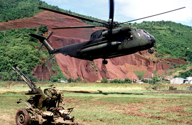
In 1983, American President Ronald Reagan ordered US troops to invade Grenada and quell the unrest taking place in the communist country. Relatively speaking, this two-month incident was rather minor, but it was not without its fiascoes. Several of those debacles were a direct result of the absurdly inadequate maps the US troops were given.
Apparently, the best maps the military could offer the soldiers were a bunch of outdated British tourist maps with hand-drawn military grid lines. Not surprisingly, this led to a rather imprecise campaign, to put it mildly. The soldiers never really knew exactly where they were or the location of the missions. Consequently, they could only guess the position and strength of enemy forces. They also lost two helicopters and had to abort at least two missions due to topographical misinformation. No map is perfect, but how could they have thought an old tourist map would even come close?
Content and copy writer by day, list writer by night, S. Grant enjoys exploring topics that are bizarre, unusual, and hiding in plain sight. Contact S. Grant here.
More Great Lists
 Top 10 Bizarre Barbershop Blunders And Breakdowns
 Top 10 Costly US Presidential Campaign Blunders
 Top 10 Blunders That Will Go Down In History - 2020
 10 Lies 'Dracula' Adaptations Tell
 Top 10 Thanksgiving Lies You Believe
 10 Reasons Our Last Hope For A Green Future Lies With China
 Top 10 Ways Hollywood Lies To You About Pirates
 10 History Lies People Still Believe Today
 10 Outright Lies People Have Spread About Mister Rogers
fact checked by
Jamie Frater
More Great Lists