 Animals
Animals
Animals  Health
 10 Things Your Poop Is Trying to Tell You
 Music
Music 10 Musical Instruments Invented in the 21st Century
 Food
Food 10 Mouthwatering Desserts That Will Satisfy Your Sweet Tooth
 Crime
Crime Ten 21st-Century American Serial Killers Who Got Away with It
 Creepy
 10 Creepy Omens That Foretold a Royal Death
 Weird Stuff
 Top 10 Weirdest Attractions at Coney Island
 Health
 10 Ancient Prosthetics That Deserve a Hand
 History
 10 Tragic and Shocking Facts about the White Ship Disaster
 Our World
 10 Bizarre Scientific Theories That Experts Are Seriously Considering
Animals 10 Absurd Times That Animals Have Run Amok
Health 10 Things Your Poop Is Trying to Tell You
Music 10 Musical Instruments Invented in the 21st Century
Who's Behind Listverse?

Jamie Frater
Head Editor
Jamie founded Listverse due to an insatiable desire to share fascinating, obscure, and bizarre facts. He has been a guest speaker on numerous national radio and television stations and is a five time published author.
More About Us
Food 10 Mouthwatering Desserts That Will Satisfy Your Sweet Tooth
Crime Ten 21st-Century American Serial Killers Who Got Away with It
Creepy 10 Creepy Omens That Foretold a Royal Death
Weird Stuff Top 10 Weirdest Attractions at Coney Island
Health 10 Ancient Prosthetics That Deserve a Hand
History 10 Tragic and Shocking Facts about the White Ship Disaster
Our World 10 Bizarre Scientific Theories That Experts Are Seriously Considering
10 Ways Space Is Unveiling The Mysteries Of Our World
Just in case the idea of showing up on Google Street View doesn’t bother you enough, there’s an amazing amount of scientific research and studies about the planet being done from orbit. It’s more than a little frightening just how much scientists and astronauts are able to tell about the planet—and us—from miles and miles away.
10Holiday Light And Energy Use
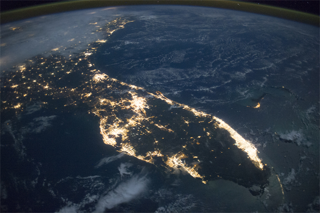
Photo credit: NASA
Chances are, the last people you’d expect to enjoy your beautiful display of holiday lights are NASA scientists. But they’re not only enjoying them, they’re making good use out of them, too.
For the last few years, scientists at NASA have been using satellite imagery to create a worldwide picture of who’s celebrating what holiday—and it’s not for the reason you might think. During the holidays, people are deviating from their usual behavior patterns. They’re going out more, staying up later, and they’re leaving more lights on around the house than they usually would, and that has a huge impact on global energy use.
Getting an accurate picture of the lights has been surprisingly difficult. In 2011, a satellite was launched with the frightening capability of being able to pick up light traces as faint as those belonging to a single-person fishing boat somewhere off the African coast. The same satellite can also sort through the overload of data that comes from the world’s most populated areas, and it was only when researchers started looking at the progression of data throughout the year that they realized they could tell exactly what countries were celebrating what holidays.
And it’s telling them a lot. Analyzing increased energy usage is also giving them insight into other things, like how the levels of carbon emissions change throughout the year and how energy demands fluctuate. Down the road, this data might lead to ways to use energy more efficiently.
9Measuring Ocean Salinity
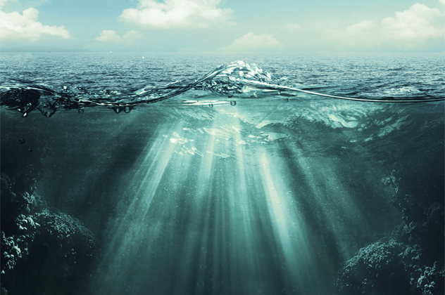
With the launch of the satellite Aquarius, NASA is getting an entirely new picture of just what the salinity levels of the planet’s waters look like. Aquarius is about 650 kilometers (400 mi) above the surface of the planet, and it orbits us in a pattern that allows it to cover the entire Earth every seven days. Capable of measuring the salinity of water to an incredibly minute degree, the satellite had already collected a staggering amount of data in its first two months in orbit—more than we’ve collected from Earth in the past 125 years.
The picture that it’s created is allowing scientists to track not only levels of salinity in the ocean, but also trace water currents, letting them see just what kind of impact melting glaciers and ice caps are having on the planet’s waterways. The satellite is also mapping freshwater currents, giving researchers a look at how the two types of water mix.
Originally launched in June 2011, the satellite cost a staggering $400 million to build, program, and launch. Two decades in the making, the entire thing began with scientists flying a small aircraft over an outdoor pool.
8Space-Based Perfumes

When it comes to using science for amazing, groundbreaking discoveries that will change our lives for the better, chances are you’re not going to think of the development of a new kind of perfume. Clearly, you don’t work for perfume manufacturers International Flowers & Fragrances.
In 1998, they teamed up with NASA to create a special sort of greenhouse that would grow flowers in space. It supplied plants with all the Earth-bound basics they would need, but after a rose spent 10 days in space, it returned smelling strangely different. This is because of the different circumstances that surround the flowers when they’re developing the essential oils that give them their smell. On Earth, the oils are created in response to pollinators or pests, and in space, there’s neither.
According to researchers, the rose they took into space had a much stronger scent than its planetside counterparts. Scent molecules taken from the space rose were then integrated into new perfumes. Companies are still sending up plants in an effort to develop new and different perfumes.
7Tracking Polar Bears
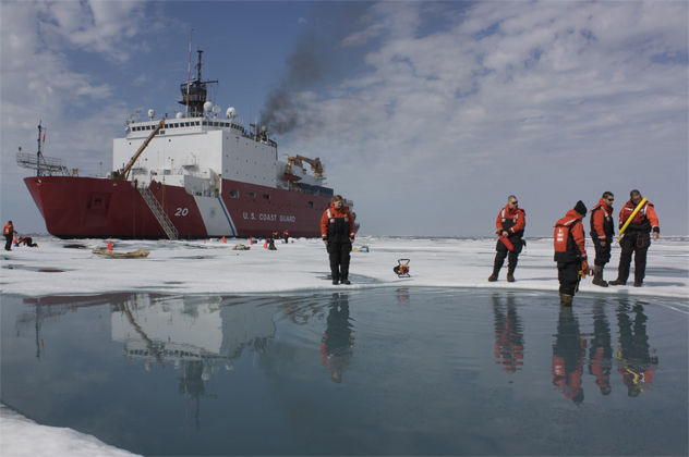
Photo credit: NASA/Kathryn Hansen
Even today, the Arctic climate presents some serious challenges to researchers looking to work in the frosty temperatures. It’s so brutal, in fact, that some scientists are finding it easier to look to space for their data collection.
Specifically, researchers are trying to determine just what kind of impact the loss of Arctic ice is having on the wildlife that relies on the ice cover for their survival. Keeping accurate tabs on how many individuals there are in wild populations can be difficult, but with satellite technology, researchers are able to keep an accurate eye on polar bear populations and where they’re going.
Original data was collected over the Canadian Arctic, where researchers from a handful of different organizations—including the Bureau of Ocean Management and the University of Minnesota—used satellite imagery to keep tabs on the bears. It proved harder than it might seem, with visual confirmation necessary for scientists to be sure that the spots they were looking at were actually polar bears.
Once they knew what they were looking for, though, they were able to compare their visual data with satellite images, ensuring that satellites will be able to allow researchers to monitor wildlife activity that would otherwise be impossible to observe.
6Measuring Gravity
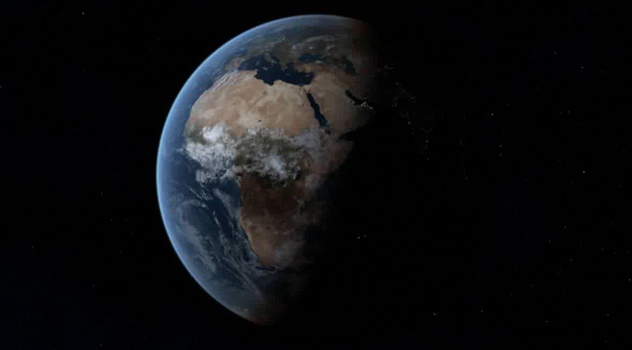
Photo credit: NASA
The planet’s mass isn’t a constant when measured at different points, and that means that gravity also changes depending on where you are in the world. It’s most noticeable at the poles, but it fluctuates everywhere. That’s what GRACE is measuring. Launched in 2002, the GRACE satellites have spent their orbital lifetime mapping the planet’s gravitational field and how it changes over the years. The project required two identical craft outfitted with GPS technology which measured the pull of the planet’s gravitational force on them.
At a glance, it sounds like there couldn’t possibly be that much to measure. But gravitational forces are incredibly delicate, and researchers are able to put together an accurate picture of just how much Earth-bound occurrences like a melting ice sheet or a shifting glacier can change the planet’s gravity. It’s also allowing them to start building an accurate map of the ocean floor based on the interaction between underwater mountain ranges and gravitational forces. Once compiled, the data will also reveal patterns in how the geographical layout of the Earth is changing and, in turn, how that is impacting ocean currents both on the surface and deep underwater.
5Mapping Soil Moisture
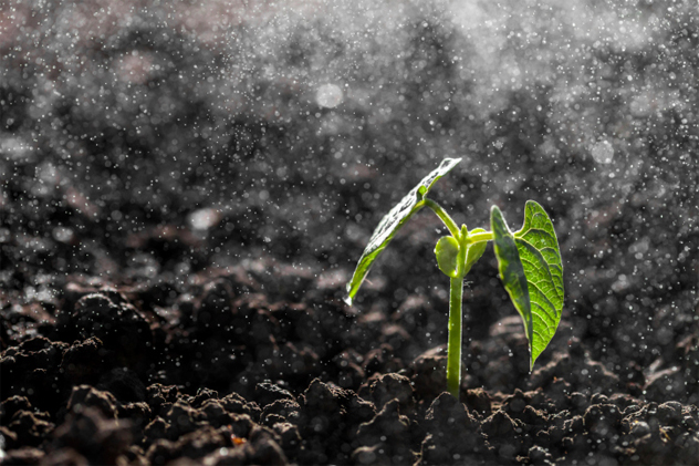
In January 2015, NASA launched their Soil Moisture Active Passive (SMAP) observatory on a three-year mission to collect data from the planet’s soil. No matter what kind of weather the satellite passes over from its height of 9 kilometers (5.6 mi), its instruments will be able to measure the amount of moisture in the top 5 centimeters (2 in) of soil anywhere in the world that’s not covered in ice or water.
SMAP will be recording a pretty mind-numbing amount of data from its orbit, since it’s able to measure water down to the moisture levels in individual soil, plant, and root particles. On a larger scale, the satellite will also be able to tell where the ground is frozen, although it won’t be able to measure ice.
The satellite will be traveling from pole to pole every 98 minutes, passing over and mapping the same area every two to three days and creating a hugely detailed map of the changes in soil conditions over the years. The impact can be staggering, as it will give researchers added insight into predicting weather patterns, determining the best times to plant, grow, and harvest crops, and predicting storms, rainy seasons, and changes in the weather patterns. Once they have yearly data, they’ll also be looking at how weather conditions change from year to year, and they’ll even be able to spot signs that an area is heading into a period of crop failure and famine.
43–D Forest Mapping
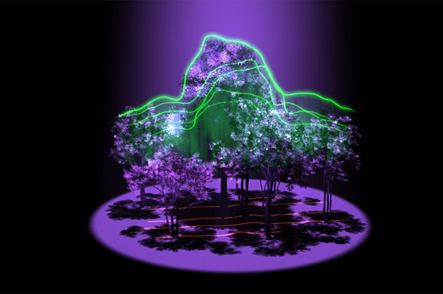
Photo credit: NASA’s Goddard Space Flight Center
In a recently green-lit project headed by the University of Maryland, NASA is going ahead with a program called Global Ecosystem Dynamics Investigation, or GEDI. Once launched, GEDI will be able to create incredibly detailed 3–D images of the planet’s forests.
The project will involve a series of optic sensors and lasers that will be beamed through forest canopies and reflected back into space. The time it takes the reflections to return, along with any interference that they encounters on the way, will be translated into a map of the forest below. The plan is to use around 16 billion of these laser pulses each year to map every temperate forest and rain forest on the planet. The maps will be so detailed that project leaders expect to be able to estimate the age of every tree in every forest.
The satellite will be able to tell where the tree canopy starts and how thick it is, as well as what the forest beneath looks like. That will, in turn, translate into a concrete map that shows just how climate change is impacting the world’s forests, how much carbon is being stored by the world’s trees, and how healthy the forests are in terms of biodiversity and animal habitats.
3ECOSTRESS
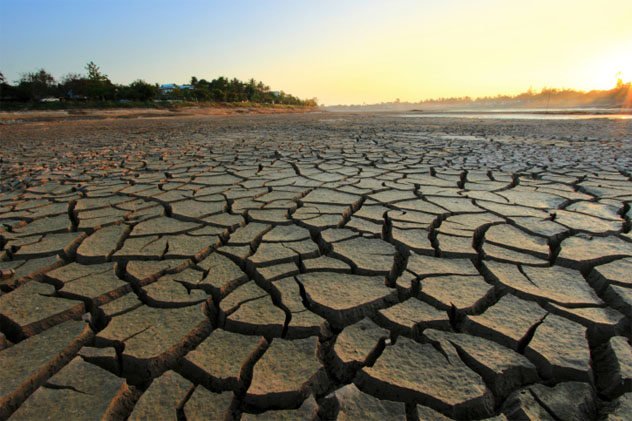
The ECOSystem Spaceborne Thermal Radiometer Experiment (ECOSTRESS) is another of NASA’s projects that’s currently in the early stages of development, and its ambitious goal is to monitor the health of the world’s plants. The satellite will be capable of high-resolution, high-frequency measurements that will show how much water plants are losing through their pores, along with how much water is evaporating from the soil. It’ll also be looking at the temperatures of individual plants across the world by measuring the heat that’s given off from the planet’s surface compared against the heat signatures of individual plants.
Because all plants need a certain amount of water to survive, the satellite information will be able to detect problems before the plants actually begin to show signs of the stress that comes from water shortages. Researchers who are monitoring the data will be able to see crop failures before they happen and drought conditions that are just starting, and, most importantly, they’ll be able to do something about it before plants begin to die.
The satellite will pass over the same area about every four days, presenting an ever-evolving snapshot of farm, garden, and ecosystem conditions. The US Department of Agriculture is also getting involved in the project, hoping that eventually they’ll be able to pass on the information to farmers to allow them to make the best decisions for watering and irrigating their crops. In many areas, there are some pretty massive disagreements about the best way to use water resources, and ECOSTRESS will also be providing an overall picture of the planet’s water cycle to help maximize usage and crop efficiency.
2High-Resolution Maps Of Everything
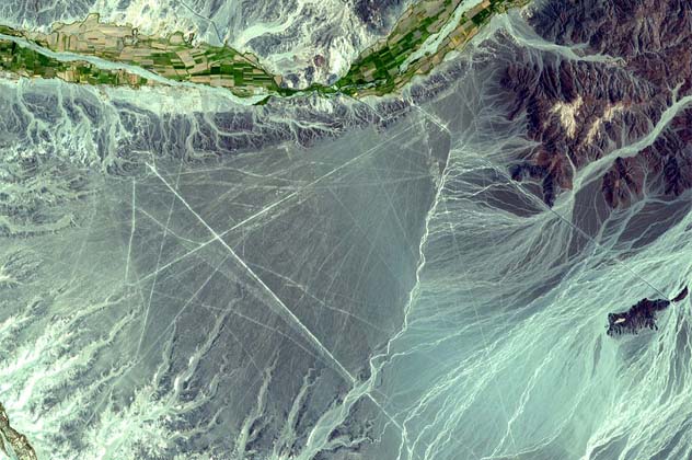
ASTER is an ongoing, joint project between NASA and Japan’s Ministry of Economy, Trade, and Industry, and is part of another satellite mission that was originally launched in 1999. Specifically, though, ASTER is taking incredible, high-resolution pictures of pretty much everything on the planet, and it’s seen some amazing things.
One of the most fascinating applications of the photos taken by ASTER has been archaeology. The high-res photos have revealed things like exposed fossils, bones, and stone tools in the Olduvai Gorge in Tanzania. The fossils are estimated to belong to one of the earliest human civilizations in history, dating back to 2.1 million years ago. The area, which was excavated in the 1930s, was also the site of the discovery of some of the oldest human fossils on record.
The data coming from ASTER is distributed to a huge amount of researchers monitoring a surprising range of natural phenomena. ASTER is allowing for the prediction of volcanic eruptions, the monitoring of the start and spread of wildfires, the creation of lava lakes, massive changes in the planet’s landscape due to erosion, rising sea levels, and deforestation. They’re also using the data to monitor protected areas like national parks and green spaces.
1Mapping The World’s Waters
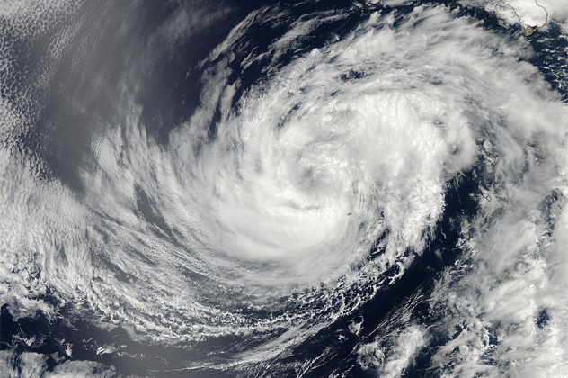
Photo credit: NASA Goddard MODIS Rapid Response Team
The United States, Canada, and France are collaborating on a project to essentially map the surface of the world’s waterways to a ridiculously exact degree. The Surface Water and Ocean Topography (SWOT) mission began in 2007 with the goal of creating a global picture of the world’s water.
The satellite maps about 90 percent of the planet’s water, recording surface height that’s accurate to within 0.8 centimeters (0.3 in). This will provide an unprecedented look into the ocean currents that, until now, we’ve known next to nothing about. Until recently, most of our knowledge of ocean currents came from tracking the paths of floating garbage, but with the SWOT program, researchers will be able to compare real-time images of ocean currents with other data—like weather patterns—in order to put together a complete picture of how the planet’s waters are changing over time.
It’s also going to be providing new insight into the world’s freshwater areas, showing researchers how water in the global water cycle is transferred and how water on the boundaries between freshwater and saltwater bodies interacts. The amount of data and the impact is pretty staggering—it’ll help us predict weather patterns and make ocean travel and navigation more efficient, to name a few applications. It’ll also provide data that will help hopefully ease some inter-governmental tensions, with advance warning for potential drought conditions, low levels in reservoirs, and potential problems with rivers shared by several countries or states.
More Great Lists
 10 Paranormal Mysteries That Are Not Paranormal Mysteries
 10 Unconventional Ways We Could Travel To Space…
 10 Creepy Mysteries From Around The World, Including…
 10 Bizarre Unsolved Mysteries Of The World
 10 Ways Life Will Change If China Becomes The…
 10 Ways Origami-Inspired Designs Can Be Used In The…
 Top 10 Ways Candles Ruin Your Life And Signal The…
 10 Ways You're Picturing The World Incorrectly
 10 Ways Uber Is Shaping The Modern World
fact checked by
Jamie Frater
More Great Lists