 Movies and TV
Movies and TV
Movies and TV  History
 10 Wild Stories About America’s Most Fascinating Founding Father
 Our World
 10 Astonishingly Valuable Things Their Owners Simply Walked Away From
 Humans
 10 Disturbing Communities from the Dark Corners of the Internet
 Movies and TV
 10 Hollywood Style Choices That Backfired
 Weird Stuff
 10 Ancient Chores That Would Horrify Modern Health Inspectors
 Politics
 10 Strange High-Tech Tools Shaping Modern Politics
 Humans
 10 Extraordinary Places Humans Have Adapted to Live
 Weird Stuff
 Ten of the Strangest Things You Can Buy Online
 Movies and TV
 10 Crime Shows with Gorgeous Settings
Movies and TV 10 Amazing Lost Films That Were Found Again
History 10 Wild Stories About America’s Most Fascinating Founding Father
Our World 10 Astonishingly Valuable Things Their Owners Simply Walked Away From
Who's Behind Listverse?

Jamie Frater
Head Editor
Jamie founded Listverse due to an insatiable desire to share fascinating, obscure, and bizarre facts. He has been a guest speaker on numerous national radio and television stations and is a five time published author.
More About Us
Humans 10 Disturbing Communities from the Dark Corners of the Internet
Movies and TV 10 Hollywood Style Choices That Backfired
Weird Stuff 10 Ancient Chores That Would Horrify Modern Health Inspectors
Politics 10 Strange High-Tech Tools Shaping Modern Politics
Humans 10 Extraordinary Places Humans Have Adapted to Live
Weird Stuff Ten of the Strangest Things You Can Buy Online
Movies and TV 10 Crime Shows with Gorgeous Settings
10 US Towns Named After Elements
Due to this countries rich mining and industrial heritage, the periodic table of the elements has provided many US towns with their name. Let’s take a virtual driving tour of ten of these “elemental” locals, ranked by their atomic number (the number of protons in the nucleus of an atom) from heaviest to lightest.
10
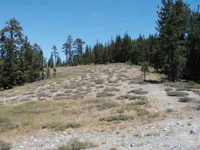
Radium Texas
Atomic Number = 88
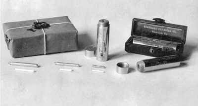
Radium is one of the Group 2 alkaline earth metals. Highly radioactive, it was used in self-luminous paints made infamous by the “Radium Girls”, who ingested large amounts of deadly radium when they used their lips to sharpen the points of their brushes. They used the brushes to paint the radioactive radium paint onto watch dials and aircraft instruments. The Radium Girls died slow, horrible deaths from the radiation.
Radium Texas, on U.S. Highway 83, ten miles northwest of Anson in western Jones County, originated with J. M. Williford’s store, in 1910. The population of Radium hasn’t changed much in the last one hundred years. It was ten in 1915 and twenty in 1940. The population of Radium was estimated at twenty-six in 1980 and 1990. In 2000 the population was ten. Apparently the population of radium Texas has never exceeded its atomic number (88). Radium is a trading center for Thompson Creek ranchers and farmers. William Lawrence Chittenden, the “Poet Ranchman,” drew his materials from his experiences as a rancher in the area.
9
Lead South Dakota
Atomic Number = 82
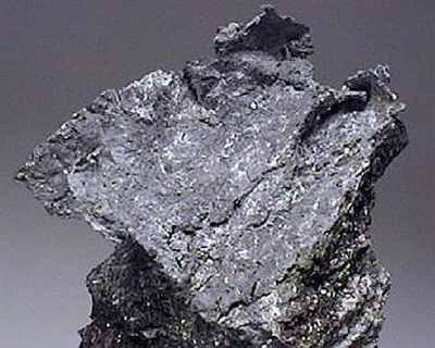
Lead was one of the earliest metals used by man. Today it is used in the manufacture of batteries, bullets, solder, pewter, etc. Lead is toxic to humans, especially children, and lead poisoning, mostly from years of using lead-based paint in houses, is still a major health problem in the USA. Lead South Dakota (actually pronounced “leed”) is a city in Lawrence County, South Dakota, with a population of 3,027 at the 2000 census. Lead is located in western South Dakota, in the Black Hills near the Wyoming state line.
The city was officially founded in July 10, 1876, after the discovery of gold. It is the site of the Homestake Mine, the largest, deepest (8240 feet/2512 meters) and most productive gold mine in the Western Hemisphere, before closing in January, 2002. Why it was never called “Gold” South Dakota is a good question, but where one finds gold, it is also common to find lead. Thanks to the gold, in 1910 Lead had a population of 8,382, making it the second largest town in South Dakota.
Lead was originally founded as a company town by the Homestake Mining Company, which ran the nearby Homestake Mine. Today, Lead and the Homestake Mine have a different use. They have been selected as the site of the Deep Underground Science and Engineering Laboratory, a proposed NSF facility for low-background experiments on neutrinos, dark matter, and other nuclear physics topics, as well as biology and mine engineering studies.
In 1974, most of Lead was added to the National Register of Historic Places under the name of the “Lead Historic District.”
8
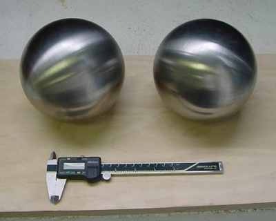
Mercury Nevada
Atomic Number = 80
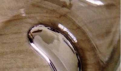
Mercury is that silvery metal that forms little blobs that you could roll around with your finger in science class, or when you broke a thermometer. It is also highly toxic. Mercury is also a town in Nye County, Nevada – 5 miles (8km) north of U.S. Route 95 and 65 miles (105km) northwest of Las Vegas. It is situated within the Nevada Test Site, and was constructed by the Atomic Energy Commission to house and service the staff of the test site. Today, the site is governed by the United States Department of Energy. As part of the test site, the town is not accessible by the general public. It was named for the mercury mines which flourished in its general vicinity, a century before the town itself was established. The current population is unknown.
Mercury began as a military-style encampment, Base Camp Mercury, set up to provide only the most basic facilities for personnel involved at the beginning of operations of the Nevada Test Site, in 1950. As the scope of the testing program expanded, so did the amount of personnel required to fulfill the site’s mission, and, beginning in 1951, a 6.7 million dollar construction project was undertaken to provide adequate individual housing, office and service structures with a civilian town-like design. With the acquisition of a full-service post office in the mid-1950s, Base Camp Mercury was formally re-named Mercury, Nevada.
In the early 1960s, the town population had grown to over 10,000, and further construction work was undertaken to upgrade the permanence of the town’s architecture. A school was established, and numerous recreational and shopping facilities were added, including a movie theater, bowling alley, recreation hall, swimming pool and hobby center, as well as a full-care health clinic, library, non-denominational chapel with cadre of chaplains, service station with garage, and bus station. In 1963, the Desert Rock Airstrip was added pending a visit from President John F. Kennedy.
The town thereafter flourished until the 1992 nuclear testing accord was signed by President George H. W. Bush, ending Mercury’s reason for being. The population shrank rapidly thereafter, leaving most of the facilities abandoned. A skeletal crew of scientists and military remain in Mercury, conducting some limited testing and research. Most of the amenities have been closed and the town is now a shell of its former self, though dining, bar facilities and a gym remain.
Maybe you can’t visit Mercury, but you can take a tour of some of the nuclear test site areas, but only when the Government is offering the tours. For more information visit The Atomic Tourist here.
7
Platinum Alaska
Atomic Number = 78
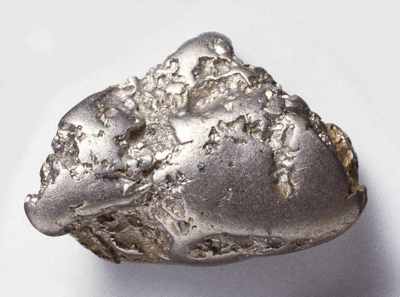
As a pure metal, platinum is silvery-white in appearance, lustrous, ductile and malleable. Platinum’s resistance to wear and tarnish is well suited for making fine jewelry. The metal has an excellent resistance to corrosion and high temperatures, and has stable electrical properties. All of these characteristics have been exploited for industrial applications. Platinum Alaska is located on the Bering Sea coast, 440 miles (716km) west of Anchorage. As of the census of 2000, there were 41 people in the town. Nine out of ten inhabitants were Native American.
Platinum is near a traditional village site called Arviq. The community was established shortly after traces of platinum were discovered, by an Eskimo named Walter Smith, in 1926. Between 1927 and 1934, several small placer mines operated on creeks in the area. Some 3,000 troy ounces of platinum were mined over that period, with a value of about $48 per ounce (on August 2, 2010, platinum was listing on the open market for around $1,569 per ounce).
The “big strike” occurred in October of 1936, which brought a stampede of prospectors for “white gold.” The claims proved to be too deep for hand mining methods, and were bought out by two companies. The largest, Goodnews Mining Co., eventually acquired title to over 150 claims. In 1937, a large dredge was built at the mining site, about 10 miles from the village of Platinum. The Company also constructed bunkhouses, a recreation hall, offices, shops and a cafeteria. Platinum developed as a “company town,” with the store, water and electricity supplied by the mine. A school opened in 1960. By 1975, 545,000 ounces of platinum had been mined at the site. The mine was sold to Hanson Properties, who estimate reserves of over 500,000 ounces. The mine ceased operations in 1990.
6
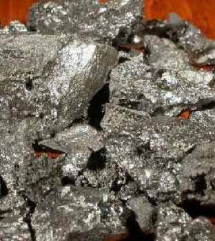
Tungsten Colorado
Atomic Number = 74
Tungsten has the second highest melting point of all the elements (second only to carbon), and is more dense than lead. It is used primarily in weapons manufacture and electronics. Located near Boulder, Colorado, the little mining community of Tungsten took off during WWI, as tungsten was more valuable than gold or silver. Once the US became involved in the First World War, prices soared, and this little town in Colorado accounted for $6 million of the mineral in 1917. Its peak population was 200,000, give or take those who wandered in and out, sleeping over night. Soon the price of tungsten plummeted and the tungsten boom was over. Within a few years the town disappeared. Today, almost nothing is left and it is one of the west’s ghost towns.
5
Zinc Arkansas
Atomic Number = 30
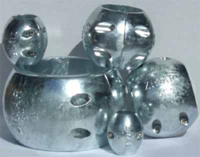
Zinc metal has been used since at least the 10th century, mixed with copper, to make bronze. Zinc is commonly used as an anti-corrosion agent in galvanized steel, in batteries and bronze. It is an essential biological mineral of exceptional public health importance, and lack of zinc in the body can lead to severe health problems, especially in children. Zinc Arkansas, (population 76) is located near the eastern border of Boone County, near the right of way of the Missouri Pacific Railroad. The Zinc area prospered from the late 1800s until, approximately, the early 1920s, because it was a significant source of mineral deposits. The principal ore was silicate of zinc.
It is written that the area produced the best grade of slab zinc that could be smelted from virgin ore. In addition to the mines, the Zinc area also contained an artesian well and numerous springs. During this time, the Zinc area was a community that was home to many people. It had a school, a newspaper and many businesses, including stores and hotels. The Zinc area prospered until the mines closed and the Great Depression occurred. Today, the city of Zinc is still home to several families; however the best part of its history has passed.
4
Iron Michigan
Atomic Number = 26
Iron is the world’s most commonly used metal, and 98% of iron is used in the making of steel. Located in the states Upper Peninsula, Iron or Iron Mountain Michigan has a population of about 8,000, and is the county seat. It also is home to one of the world’s largest artificial ski jumps. But it got its start, not surprisingly, by the quest for iron ore. As the fledgling steel industry in the US was beginning in the 1800’s, prospectors were on the lookout for good deposits of iron ore. Two such prospectors, James John Hagerman and Dr. Nelson Powell Hulst, discovered what would be called the Chapin Mine, in 1879. They had leased the land from a man, Henry Chapin, hence the name of the mine. They began to sink shafts on the slope of Millie Hill. After numerous unsuccessful shafts, the company was ready to shut down operation. Hagerman and Hulst had faith in the land and tried one more shaft. The shaft was 90 feet deep and many months later, there was a successful hit that was at the heart of the iron ore.
The original land was very swampy and filled with trees. To get rid of all this water necessitated the construction of the Cornish Pump, the largest steam-driven pumping engine in the United States. Designed in 1890, the Cornish Pump engine’s high-pressure cylinder has a 50-inch (127cm) bore, and the low-pressure cylinder is 100 inches 254cm) in diameter. The flywheel is 40 feet (12 meters) in diameter, weighs 160 tons (145,150 kg), and had an average speed of only 10 revolutions per minute. The drive shaft to the flywheel is 24 inches (61cm) in diameter. The engine itself rises 54 feet (16m) above the floor of the room. The designers estimate the weight to be 725 tons (657,708kg) over all.
The pumping equipment utilized a reciprocating motion to a line of steel rods extending 1,500 feet (457m)down into the mine, with eight pumps attached at intervals of 170 to 192 feet (52-59m) along the rods. Each of the pumps forced the water to the next higher pump, and finally out to the surface of the mine. As the engine was designed to run slowly, the pumps had a capacity of over 300 gallons ( 1,135 liter) per stroke of the pistons. At ten revolutions per minute, this meant over 3,000 gallons (11,356 liter) of water poured out through a 28-inch (71cm) pipe every minute. A total of 5,000,000 gallons (18,927,058 liters) of water could be removed from the mine each day! At that time the pump’s estimated cost was nearly $250,000.
After only a few years of successful operation, the giant pumping facility was moved from the “D” shaft of the Chapin Mine because the pump was sitting on top of more than a million tons of the best grade ore found in the entire mine. The pump operated until 1932, when the Chapin Mine permanently closed its doors. The Chapin Mine Pumping Engine (Cornish Pump) was designated as a National Historic Mechanical Engineering Monument, by the American Society of Mechanical Engineers on June 6, 1987, and has been featured in the History Channel’s Modern Marvels Series on the World’s Biggest Machines.
3
Manganese Minnesota
Atomic Number = 25
Manganese is a mineral used in steel and aluminum production. It’s also used to make batteries. Manganese was a small village in Minnesota, United States. Located in Crow Wing County, Manganese lies roughly 2 miles (3km) north of Trommald, Minnesota, and is located between Coles Lake and Flynn Lake. First appearing in the 1920 census, the village was abandoned by 1960. Named after the mining of its namesake, the village first appeared as “Manganese Village” in the 1920 Census, with a population of 183.
Over time, all of the ore had been extracted. As a result, jobs no longer remained and the residents were forced to relocate in order to find new job opportunities. Unlike all of the other towns in the area, rather than having its population decline by thirty or forty percent, Manganese lost its entire population. During the 1960s the city was abandoned; it became a ghost town. Nothing remained except for sidewalks, rubble, many building foundations, and various abandoned items. As time progressed into the 1980s, trees, roots, and shrubs began to uproot and crack through the cement sidewalks. In the 1990s, a majority of the land was purchased. It is now privately owned and has a “no trespassing” sign posted on the gate of the southeastern part of the city.
However, just north of Manganese is the little town of Emily, Minnesota. Emily could be the new Manganese because it is located next to one of the largest high-grade deposits of manganese in North America. Experts think there could be a billion pounds of manganese in the ground, just a couple miles from the town center. This could lead to an economic boom for this area, as the U.S. currently imports nearly all of its manganese.
2
Chrome Pennsylvania
Atomic Number = 24
Chromium or chrome (atomic number 24) is a Group 6, or transition, metal. Because chromium is highly resistant to corrosion, it is valuable as an additive to steel, to make chromium steel. Not far from my home town of Lancaster, Pennsylvania, the village of Chrome is located on the Pennsylvania/Maryland border near the Mason Dixon Line. The town is named for the nearby chromite mining that took place in northern Maryland and Southeast Pennsylvania. Of more significance is the unique geological feature, created by the chromite (and other metals) in the soil – The Serpentine Barrens.
The chromite is found in serpentinite rock that contains very little quartz and aluminum-bearing minerals. When serpentine rock weathers, most of the rock dissolves, leaving behind a thin, sand- and clay-poor soil which is easily eroded. Therefore, the land surface over serpentinites is stony, unfertile and sparsely vegetated – hence the term “serpentine barren.” Typically, a serpentine barren contains scrub oak and pine, cedar, grasses and some unique and rare wildflowers. These “barrens,” as they are locally called, are stretches of uncultivated countryside that stand out among the acres of green fields, soy beans, wheat, corn and other crops. Unlike most geology, plant life in “barrens” grows more heavily away from streams and water sources, because the water concentrates the chromite and other metals – metals that are toxic to the plants.
The Nature Conservancy states that Serpentine Barrens are “globally rare”, and has worked to protect the Maryland-Pennsylvania State-Line Serpentine Barrens. These Barrens contain some of the last major remnants of serpentine grassland in eastern North America. The thin soils covering this light green bedrock contain high levels of nickel, chromium and other metals that prove toxic to most plants and animals. However, while lacking nutrients, this habitat supports numerous species—many rare or endangered—that have adapted to the harsh environment over thousands of years.
As for the chromite – all the ore mined in Maryland and the adjacent region in southeastern Pennsylvania was shipped to Baltimore, and nearly all of the chrome produced in the world between 1828 and 1850 came from these areas of the US. Isaac Tyson, Jr. established a chrome plant in Baltimore in 1845, and thereby gained a monopoly in the chemical use of chrome, as well as in its mining. Maryland continued to be the principle producer of chrome until the middle of the 19th century, when the deposits in Asia Minor assumed importance, and the exports from Baltimore ceased in 1860. The Baltimore Chrome Works maintained its monopoly until 1885, and continued to do a thriving business until 1908, when the Tyson family sold out to the Mutual Chemical Company of America.
1
Krypton and Neon Kentucky
Atomic Numbers 36 and 10
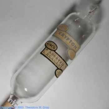
A special two-for-one noble gas related listing – Kentucky boasts not one but two towns named after members of Group 18 of the Periodic Table (the column on the far right), called the “noble gases”. There is the little town of Krypton, Kentucky, population 3,221, and none of the inhabitants, as far as we know, are named Clark Kent or Kal-El. Of slightly more interest is Neon, Kentucky or, more accurately, Fleming/Neon, Kentucky. Located on the very eastern border of the state nearest Virginia, the city was established by the Elkhorn Coal Corporation which moved in to the area in 1913. Fleming was the location of the mine and named for its first president, George W. Fleming.
A city named Chip existed near the community that became Fleming, and it was quickly built up and served as a trading center for the nearby coal towns. The train that hauled the coal out of Fleming would make stops in Neon, and it is an accepted legend by locals that a man on the train would yell instructions to people climbing on board the train saying “Knee On”. This was soon changed to Neon, and replaced the name Chip. In 1977, the two towns merged becoming Fleming-Neon
+
Boron CA
Atomic Number = 5
Boron is commonly used in the manufacture of insulating fiberglass (borosilicate) and laundry detergents (sodium perborate). It was best known as one of the primary constituents of Borax – the natural cleaner hauled out of the deserts of the Western USA by the famous “20-Mule Teams”. Boron is a census-designated place (CDP) in Kern County, California, and is located 15 miles (24km) east-southeast of Castle Butte, at an elevation of 2467 feet (751m). The population was 2,025 at the 2000 census. Boron is named after the element boron and is the location of one of the world’s largest sources of the boron compound, boric acid.
Boron is located on the western edge of the Mojave Desert. Within a half day’s drive one can view the highest and lowest points in the contiguous 48 states of the United States (Mount Whitney and Death Valley), the world’s oldest tree (the Bristlecone Pine), and the cities of both Los Angeles and Las Vegas. It all started in October, 1913, when Dr. J. K. Suckow was drilling a well for water 4½ miles (7km) northwest of Boron. Instead of water, he discovered colemanite, a borax ore. Colemanite was named after William Tell Coleman, owner of the Harmony Borax Works, who used his “20-mule teams” to haul the borax from the Death Valley mines to the nearest railroad junction. Suckow eventually sold his original well and claim to the Pacific Coast Borax Company.
In 1924, anxious to repeat his good fortune, Suckow sunk another shaft and found a 70-foot (21m) thick bed of colemanite at 210 feet (64m). In 1925, the Suckow Chemical Company produced a few hundred tons of colemanite from this shaft. In 1925, a huge deposit was found at 120 feet (37m) just 1½ miles (2km) west of Suckow’s shaft, which was sold to the Pacific Coast Borax Company in early 1926. It became known as the Baker Mine. The mining town of Boron was established soon thereafter. This borax deposit is now the world’s largest borax mine, and it is the largest open-pit mine in California. This mine supplies nearly half of the world’s supply of refined borates.
Just east of Boron, across the county line in San Bernardino County, is the world’s largest solar power production facility – the five 30-Megawatts Solar Energy Generating Systems (SEGS) facilities located in the Mojave Desert at Kramer Junction, California.
More Great Lists
 Top 10 Army Bases Named After Confederate Generals
 Top 10 Ghost Towns Inside Or Near Famous Cities
 10 Small Towns In The United States Known For Weird Things
 Top 10 Towns People Abandoned For No Reason
 Top 10 Bizarre Elements Of The Elisa Lam Case
 10 Underground Rescues That Occurred After Hope Was Lost
 10 Stories Of People Who Cheated Death Only To Die…
 10 Reasons For Keeping Human Body Parts After Death
 10 Troubling Items Left In Patients After Surgery
fact checked by
Alex Hanton
More Great Lists