 Weird Stuff
Weird Stuff
Weird Stuff  Crime
Crime The 10 Most Infamous Gangs in History
 Miscellaneous
 Ten Groundbreaking Tattoos with Fascinating Backstories
 Our World
 10 Green Practices That Actually Make a Difference
 Humans
 Ten Historic Men Who Deserve Way More Credit Than They Got
 Movies and TV
 The 10 Most Heartwarming Moments in Pixar Films
 Travel
 Top 10 Religious Architectural Marvels
 Creepy
 10 Haunted Places in Alabama
 History
 Top 10 Tragic Facts about England’s 9 Days Queen
 Food
Food 10 Weird Foods Inspired by Your Favorite Movies
Weird Stuff The 10 Weirdest Materials That Can Be Used to Make Paper
Crime The 10 Most Infamous Gangs in History
Miscellaneous Ten Groundbreaking Tattoos with Fascinating Backstories
Who's Behind Listverse?

Jamie Frater
Head Editor
Jamie founded Listverse due to an insatiable desire to share fascinating, obscure, and bizarre facts. He has been a guest speaker on numerous national radio and television stations and is a five time published author.
More About Us
Our World 10 Green Practices That Actually Make a Difference
Humans Ten Historic Men Who Deserve Way More Credit Than They Got
Movies and TV The 10 Most Heartwarming Moments in Pixar Films
Travel Top 10 Religious Architectural Marvels
Creepy 10 Haunted Places in Alabama
History Top 10 Tragic Facts about England’s 9 Days Queen
Food 10 Weird Foods Inspired by Your Favorite Movies
10 Amazing Rare Cloud Formations in Images
We have previously posted a list on rare cloud formations which proved very popular. But it was published when Listverse was still very young so it lacks beautiful images and a proper layout. Given that it was five years ago it seemed like a perfect time to revisit the topic and present some stunning images of these rarely seen clouds. So here it is – incredible and rare cloud formations as you have never seen them.
10
Stratocumulus Clouds


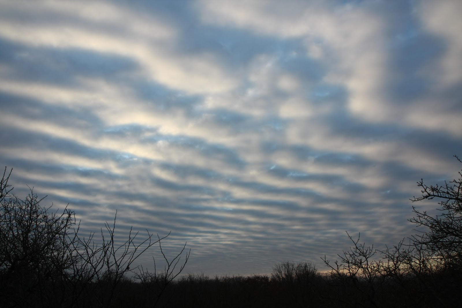
Stratocumulus Clouds are blocks of clouds which appear in waves or blobs – usually with patches of light and dark. They can vary from rather plain looking (a typical gloomy day cloud) to quite stunning – when they form into rolls or waves. The coolest thing about these clouds, however, is that they are usually the reason for crepuscular rays (the appearance of the sun firing rays from one location across the sky) and the halo seen around the moon at night.
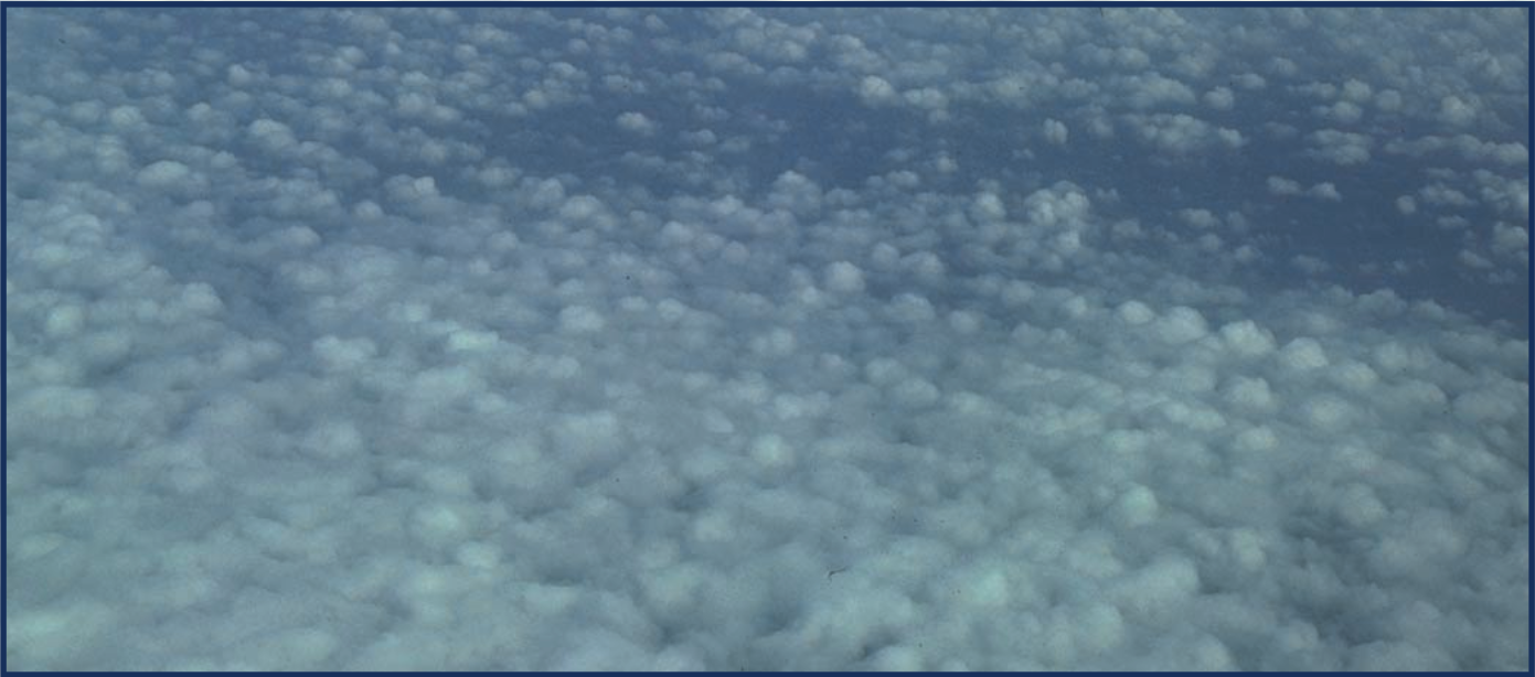
9
Pyrocumulus Clouds


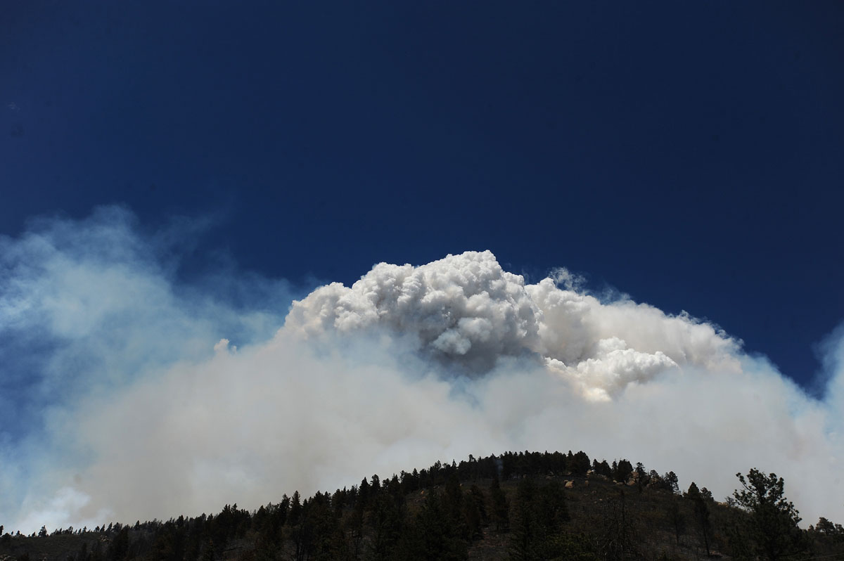
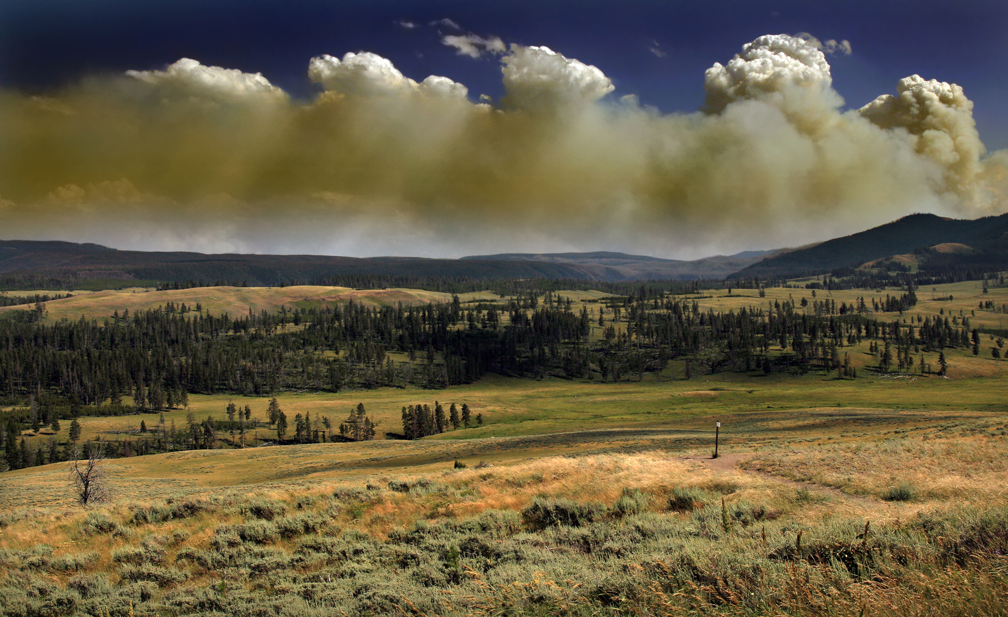
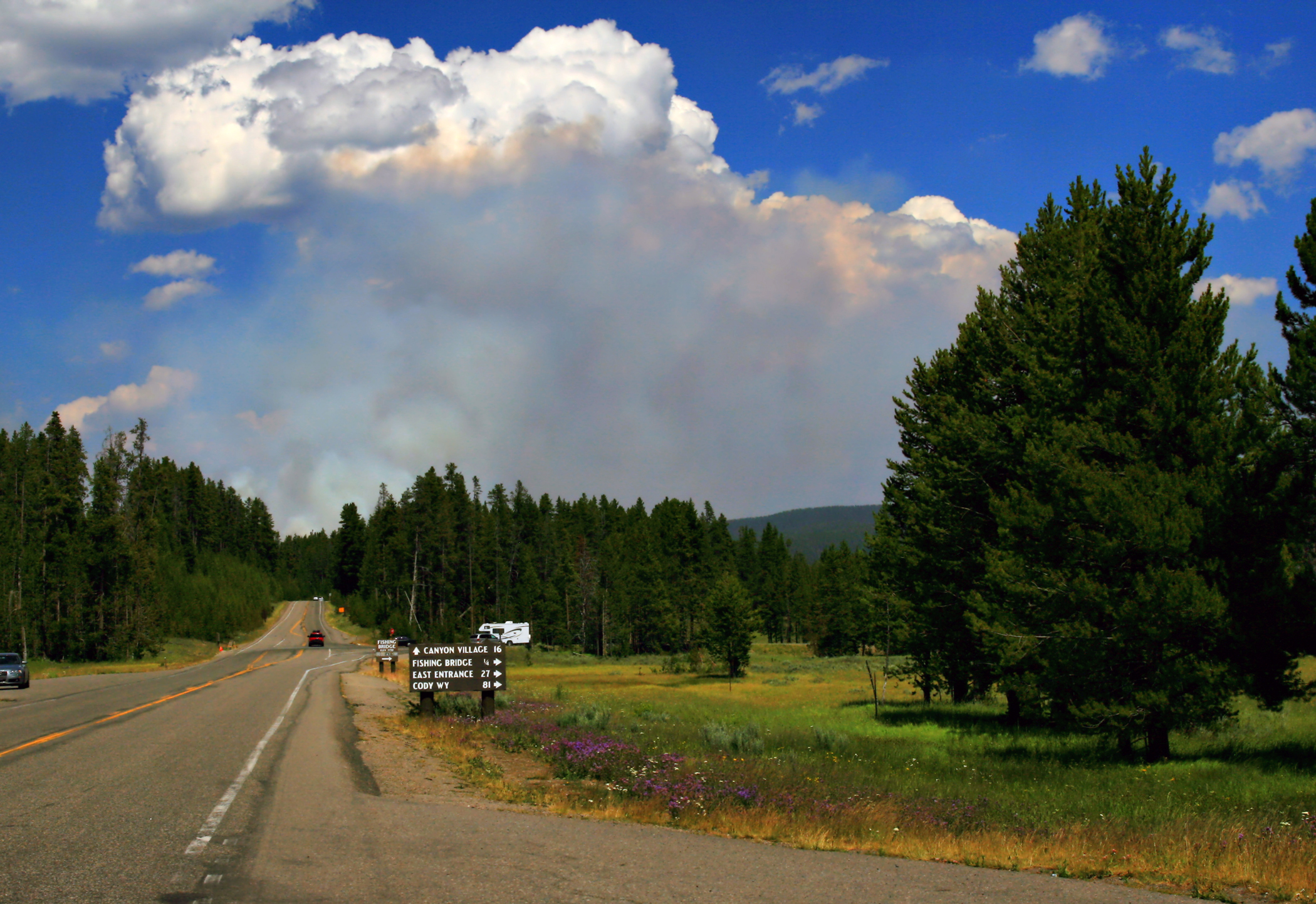
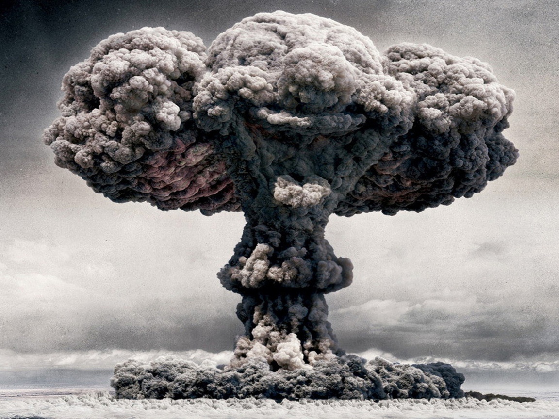
Our previous list included mushroom clouds which are generated through an atomic blast, but they are, in fact, a type of pyrocumulus cloud (fire cloud) so it seemed better to include the whole classification here. Pyrocumulus clouds are, as you might expect, created by intense heating of the air from the surface of the earth. This can either be through a bomb blast or through wildfires. They often have a grey tinge because of smoke and ash involved in the source.
8
Polar Stratospheric Clouds

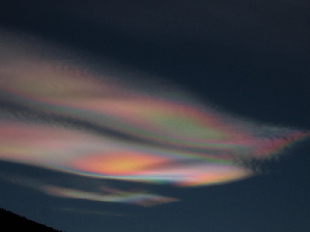
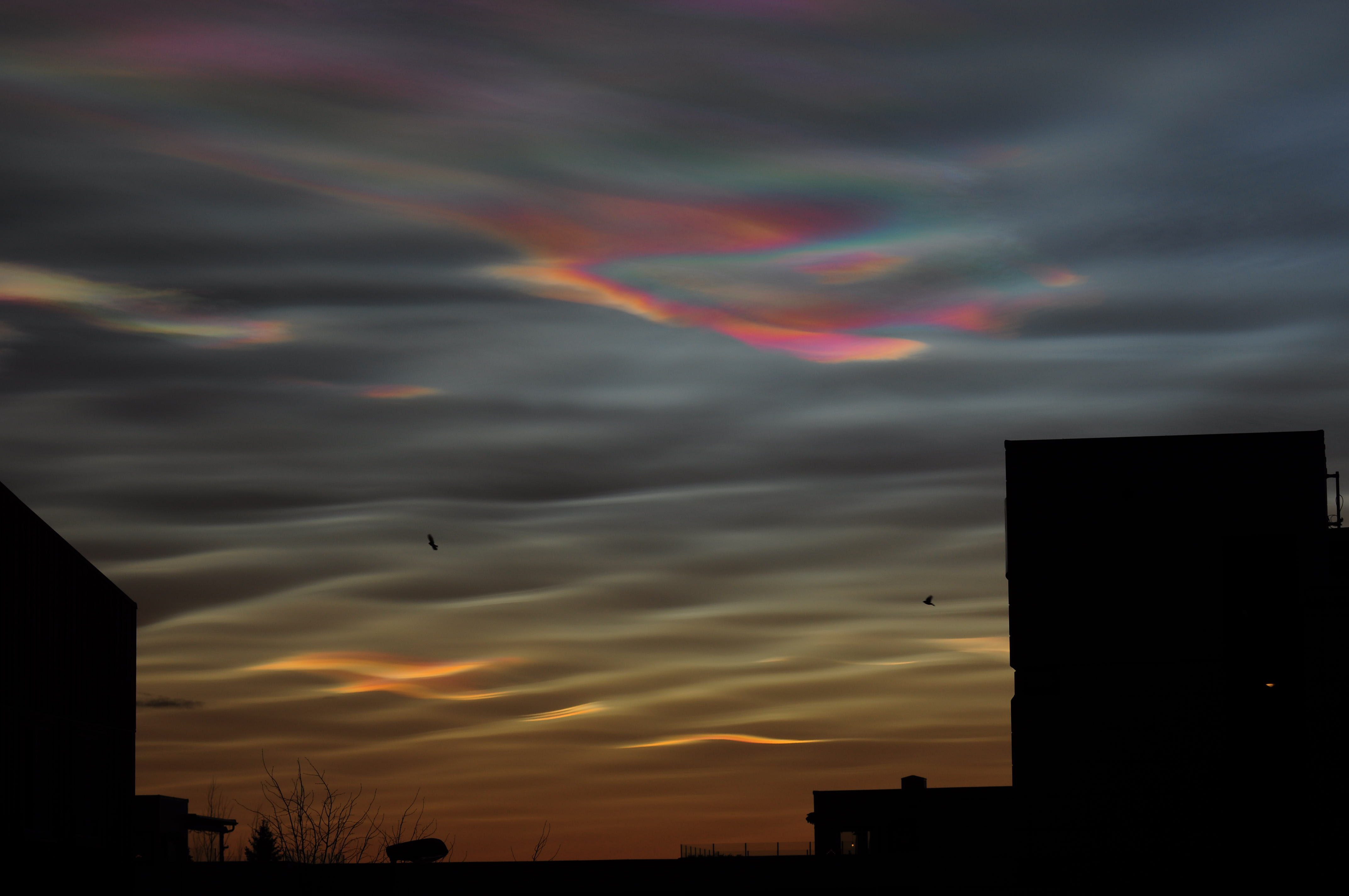
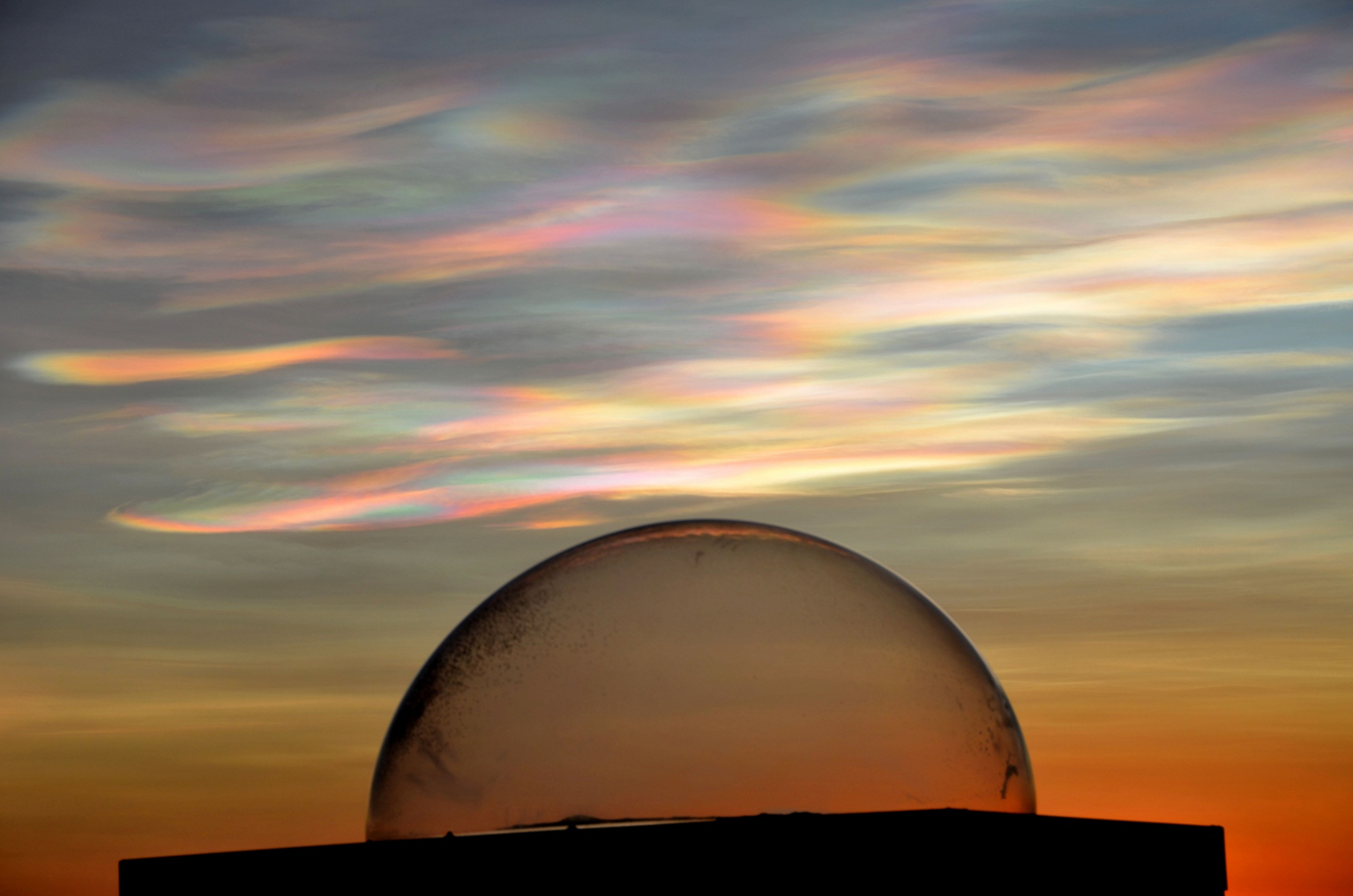
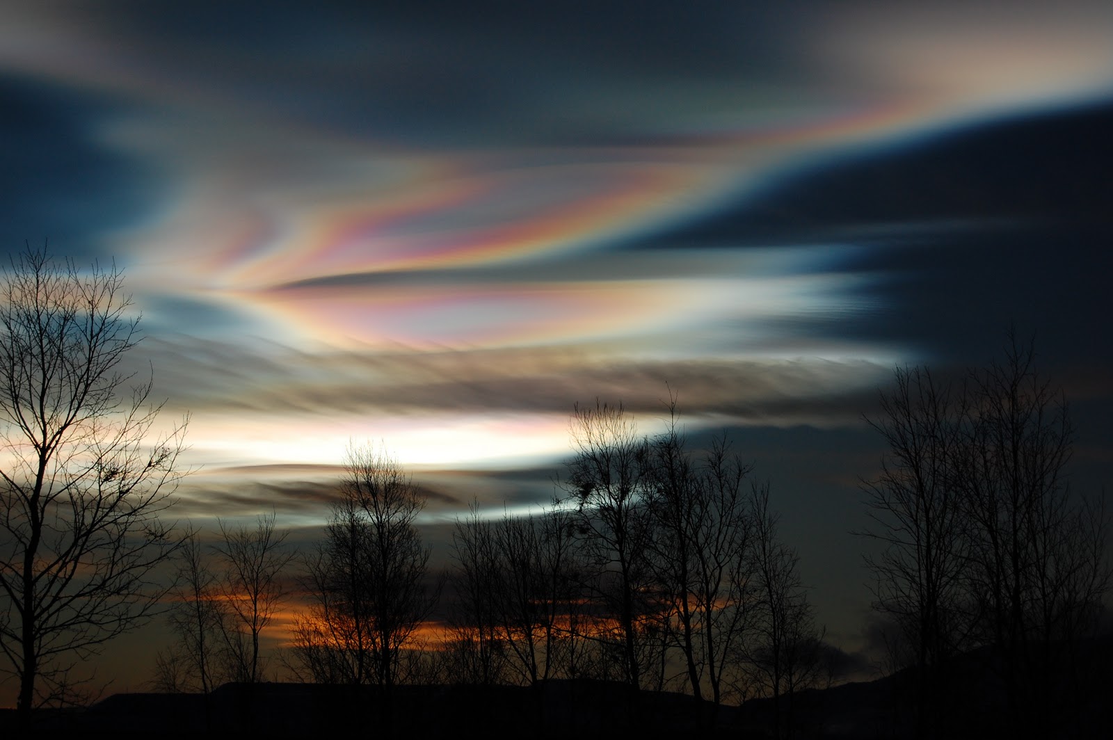
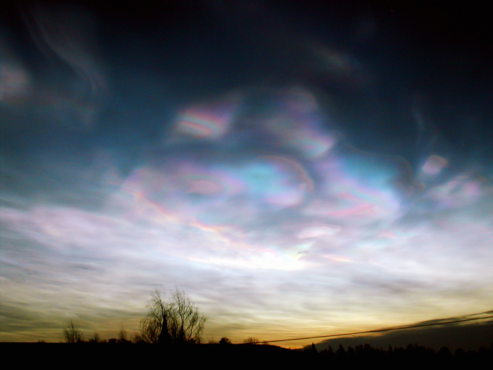
These beautiful clouds are formed extremely high in the polar stratosphere. Because they are so high they reflect light from below the horizon which results in stunning displays of color. They are also known as nacreous clouds which comes from “nacre” meaning mother-of-pearl and it is easy to see why. These clouds are especially rare because the stratosphere is typically very dry which prevents clouds of any kind from forming.
7
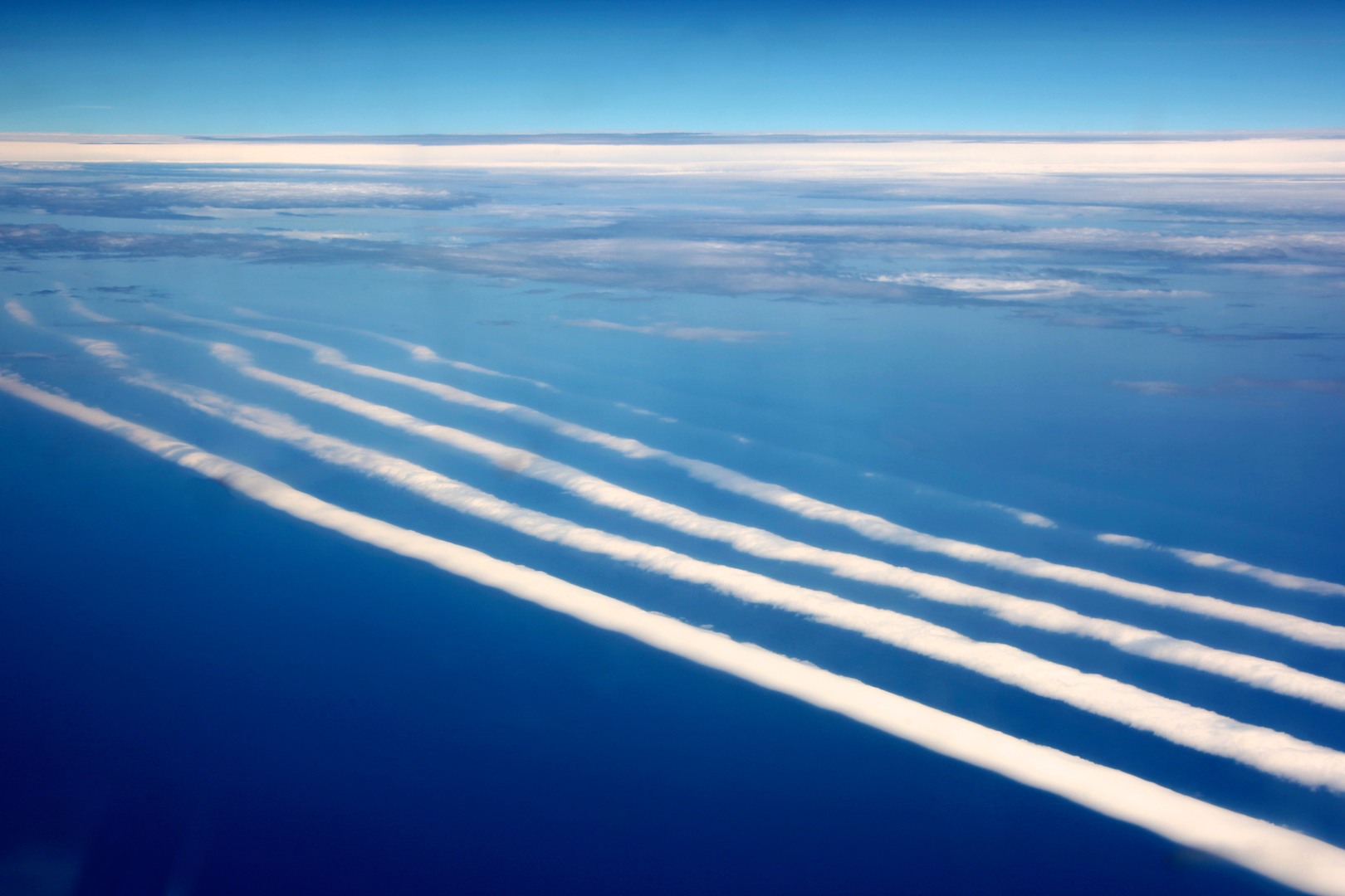
Jellyfish Clouds

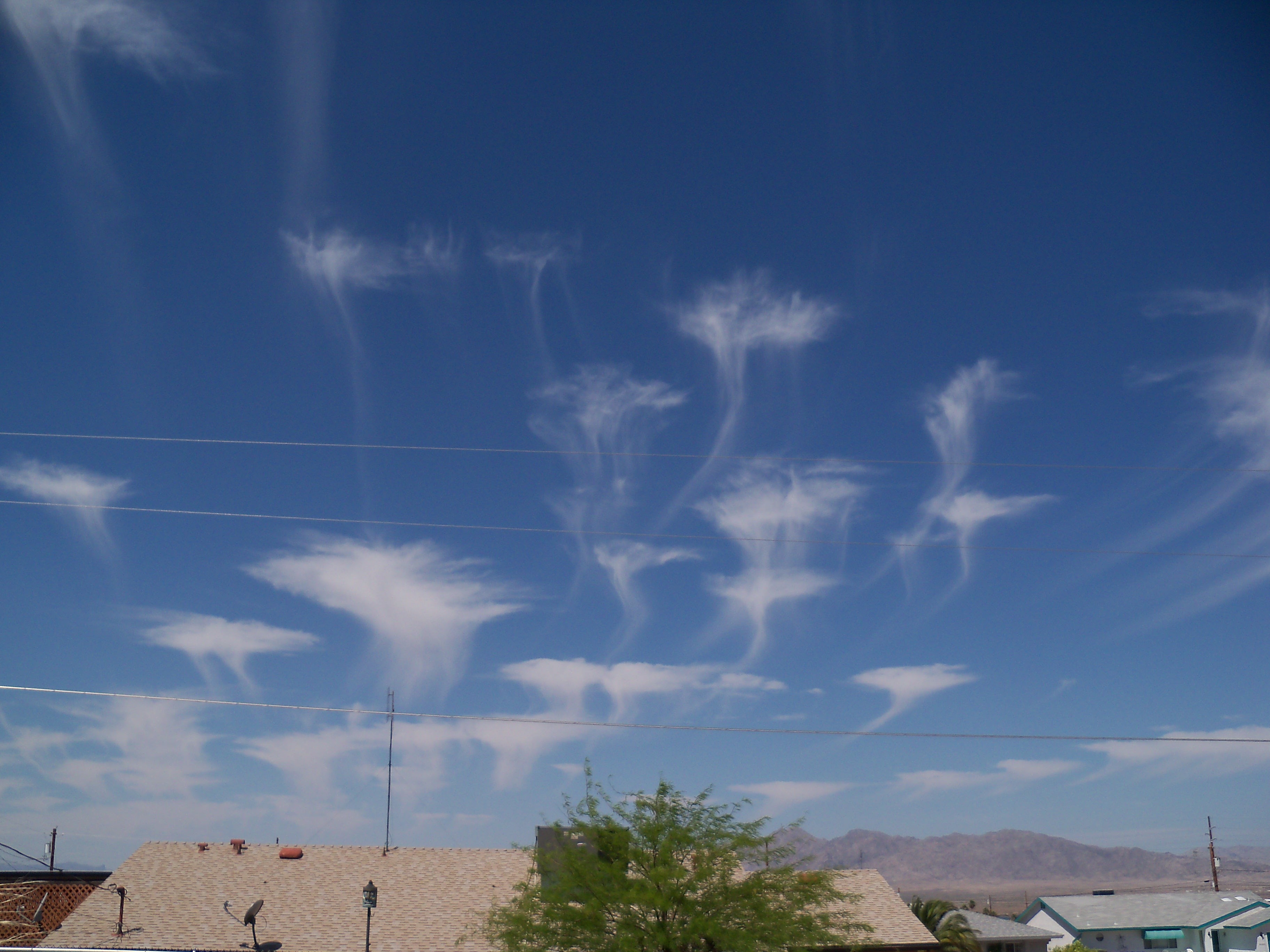
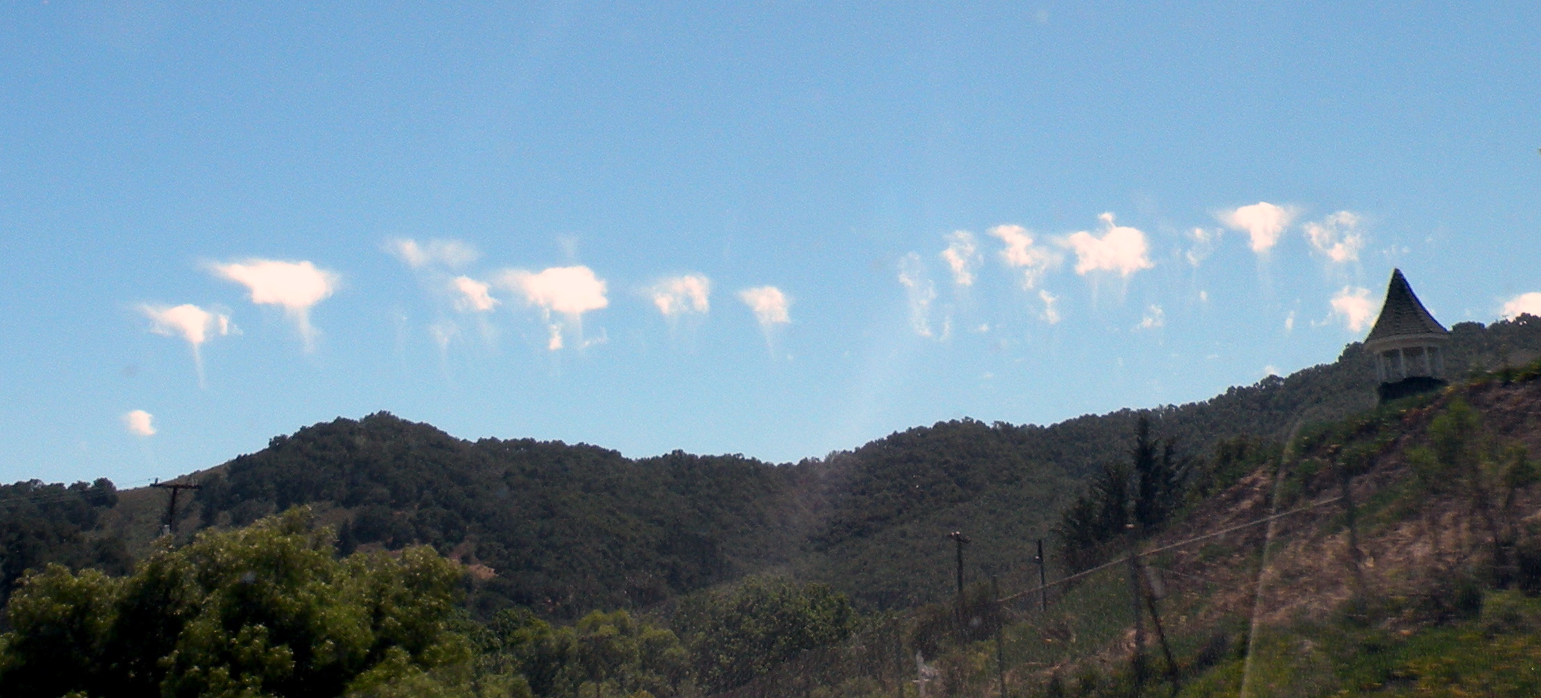
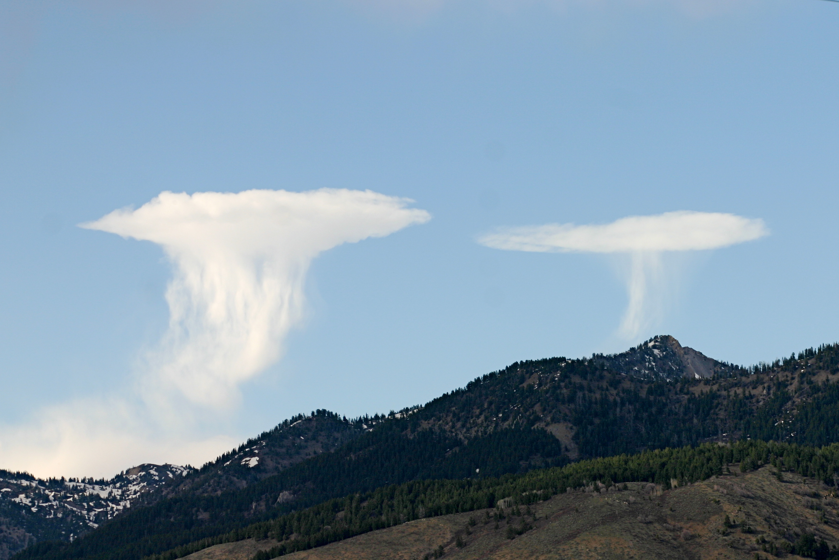
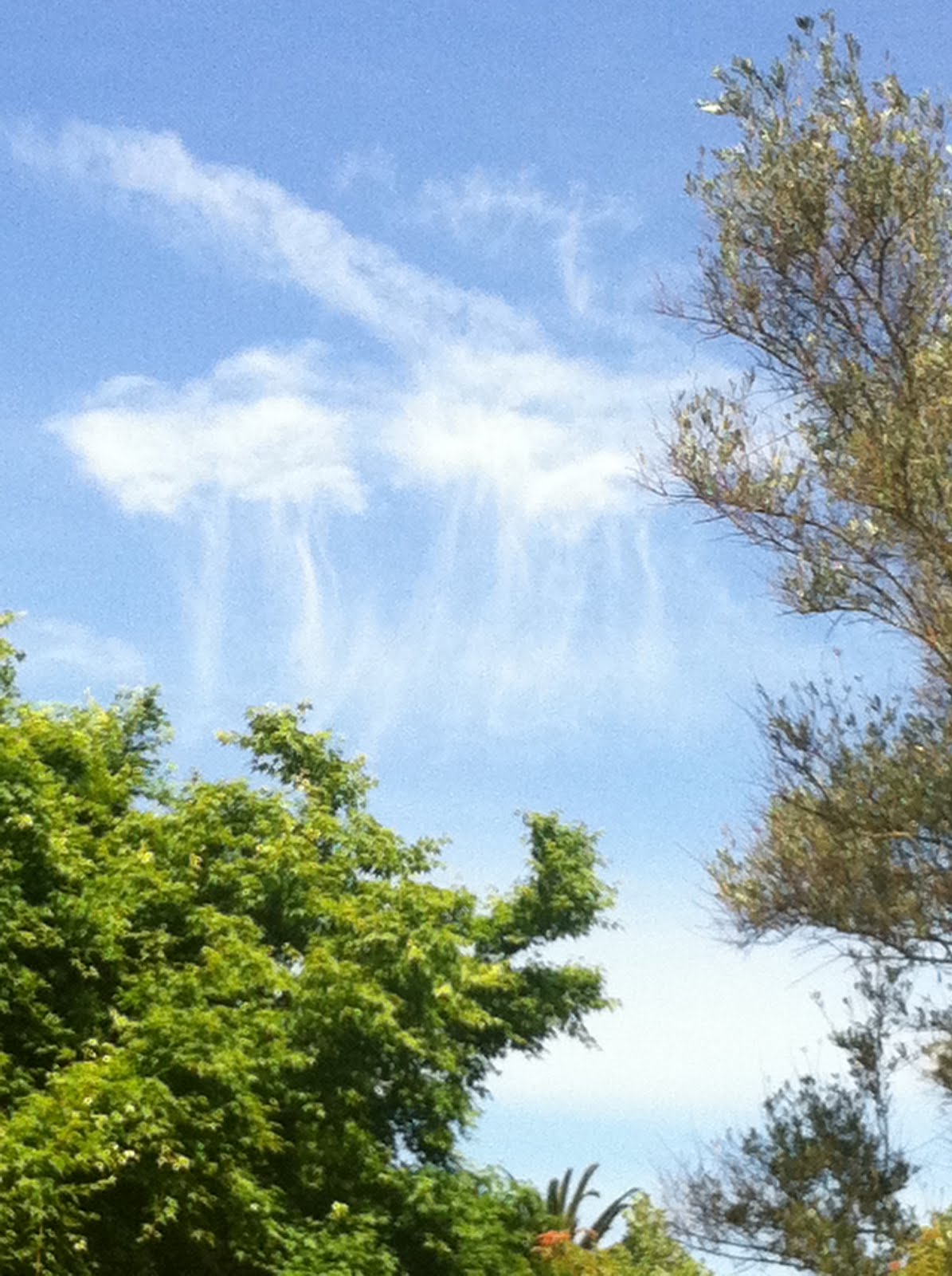
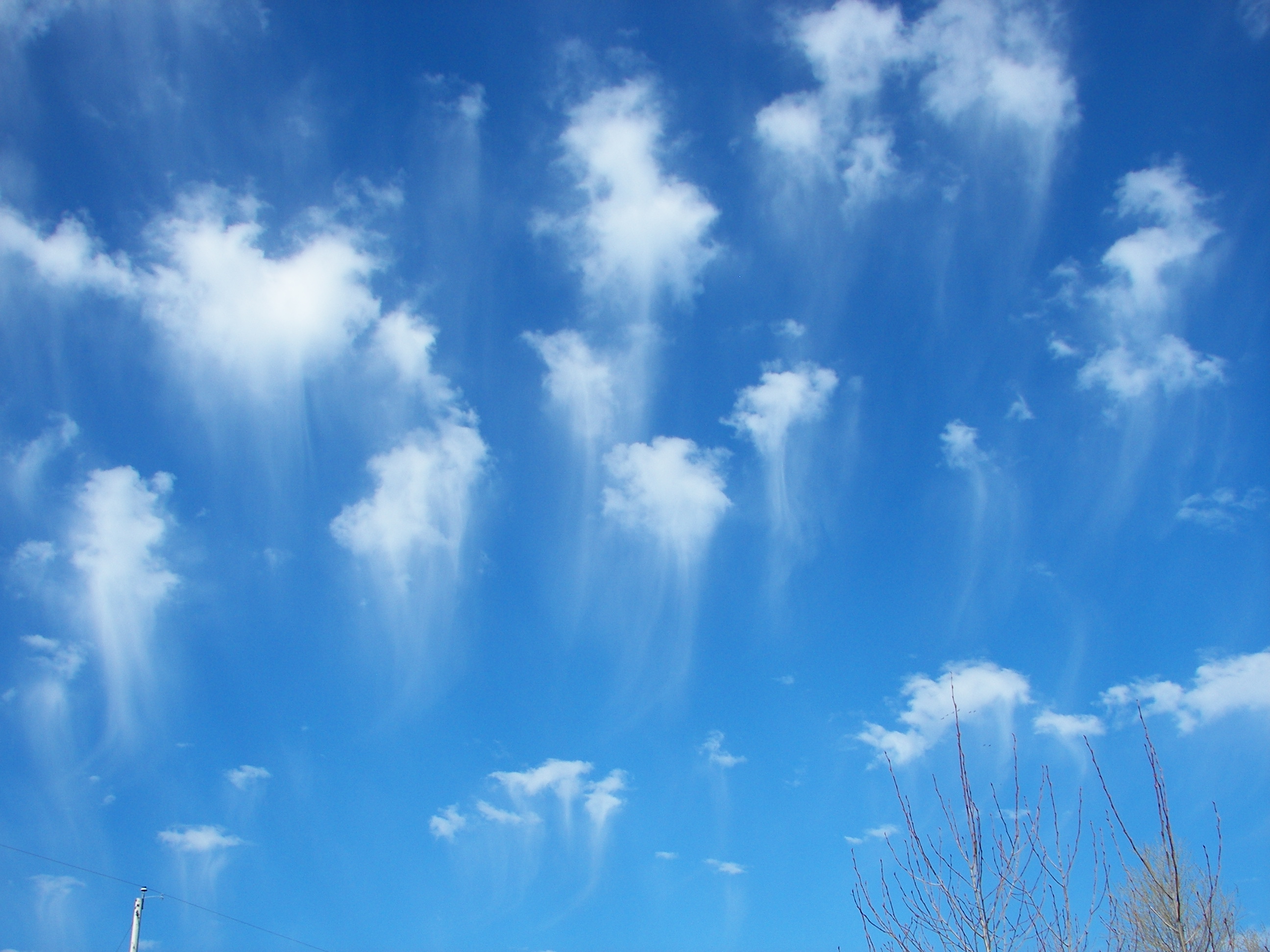
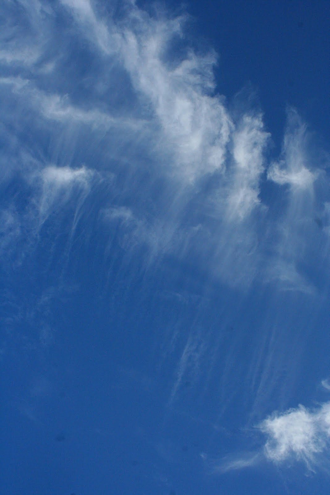
Also known as virga, these clouds have tendrils hanging beneath them which resemble a jellyfish in the ocean. The effect is caused by water or ice falling from the clouds but evaporating before they hit the ground. These clouds are often seed clouds for rain storms. While these are rare for most parts of the world, they are not uncommon in desert areas and on prairies.
6
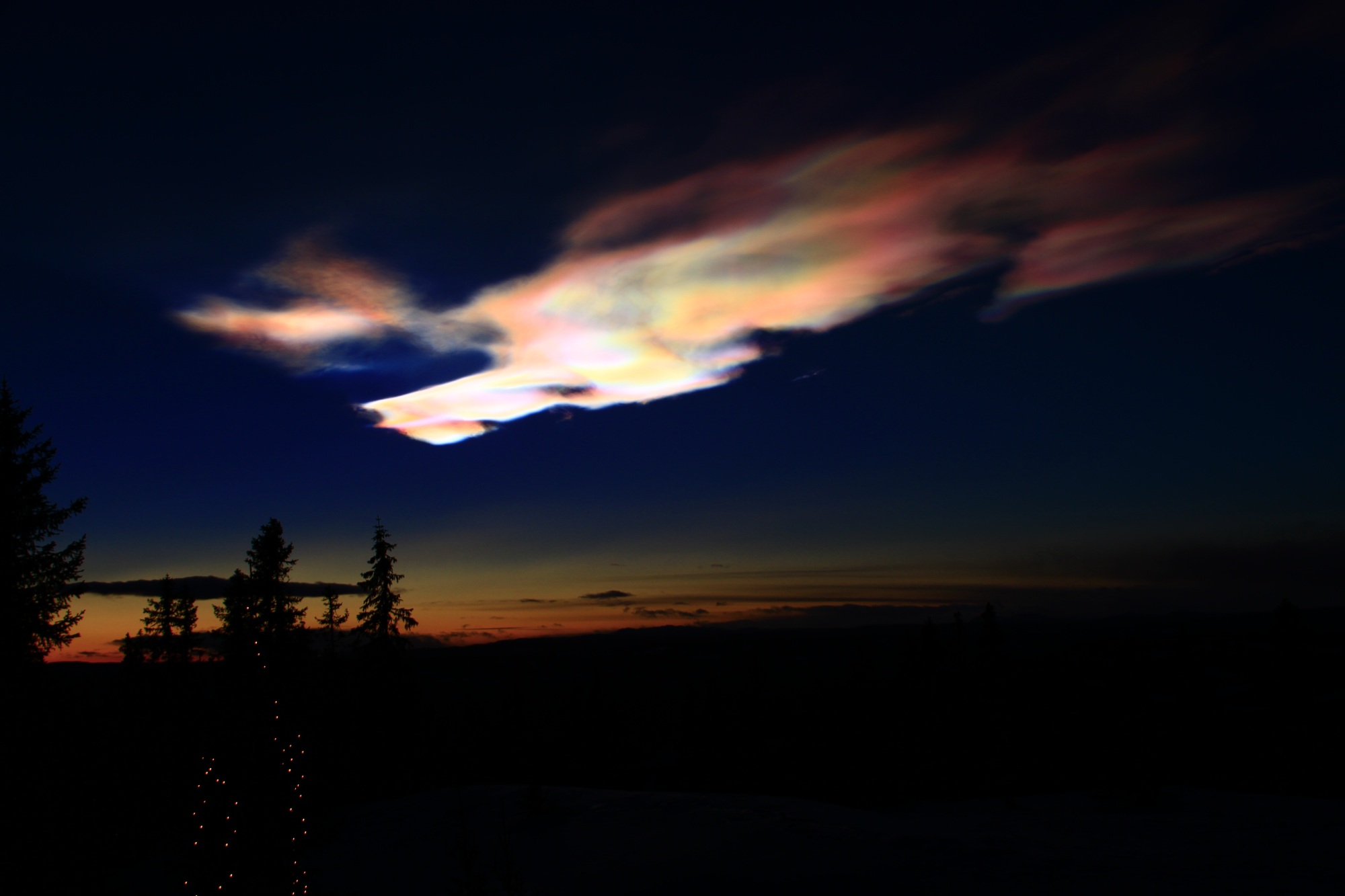
Noctilucent Clouds


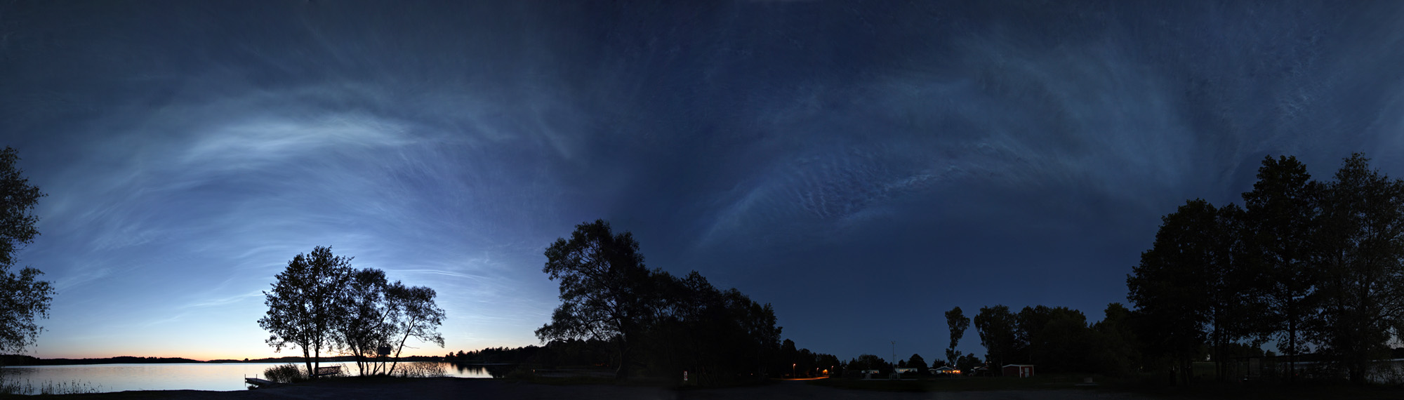


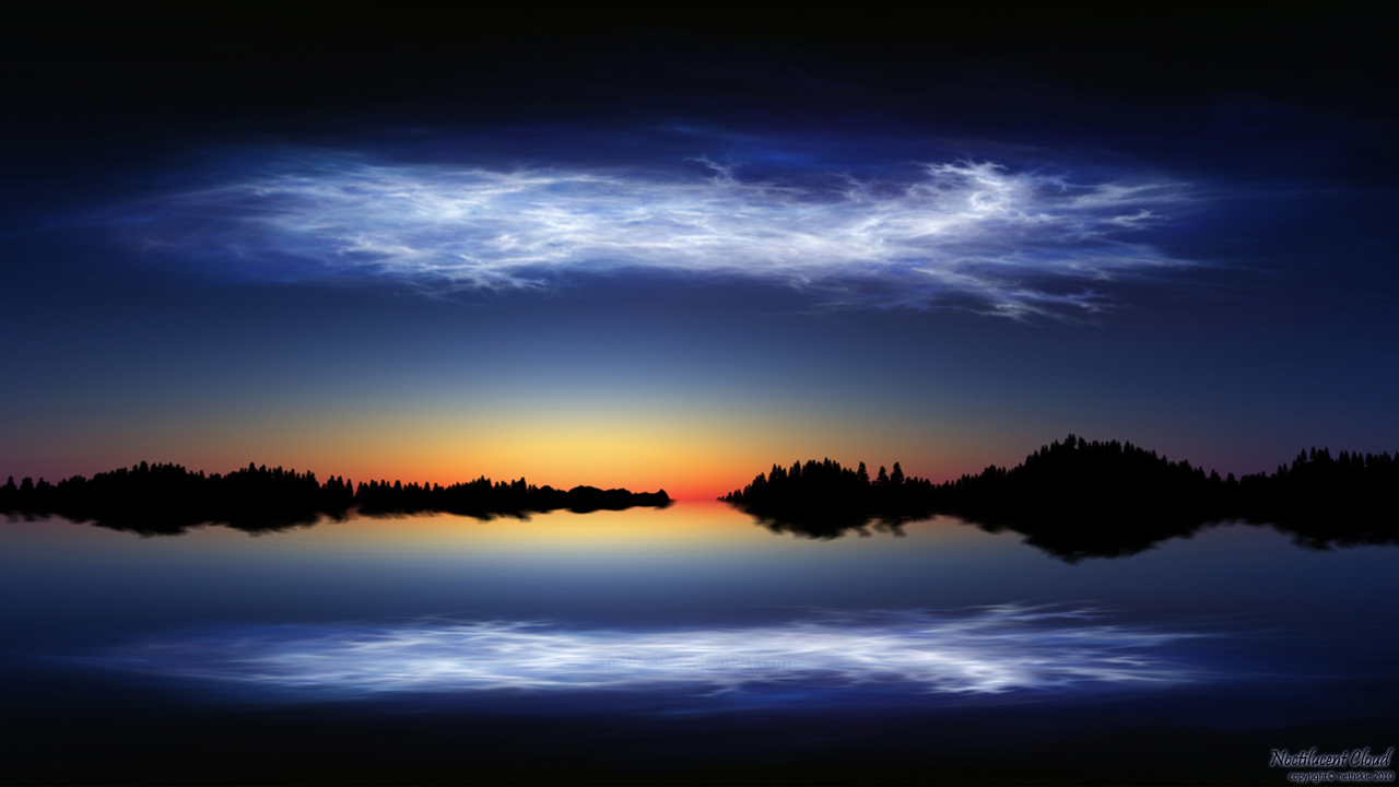

Unlike the similar Polar Stratospheric clouds, noctilucent (or polar mesospheric clouds) occur in the polar mesosphere. These clouds are only visible when the sun is below the horizon and they are composed entirely of ice. They are less likely to be rainbow colored and tend to glisten like crystal due to the level of ice contained in them. Both these and polar stratospheric clouds are good examples of how something simple (like a cloud) can be something incredible merely because of its location in the sky.
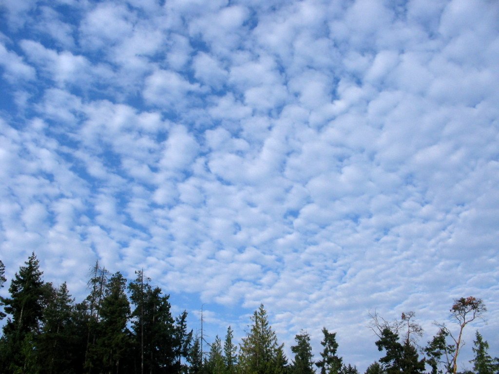
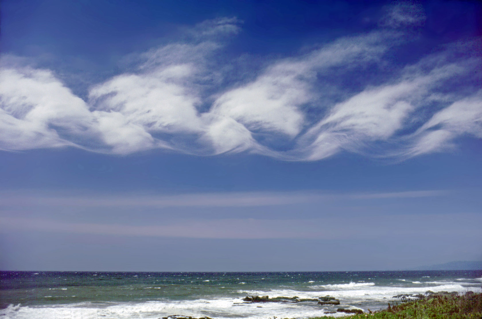
5
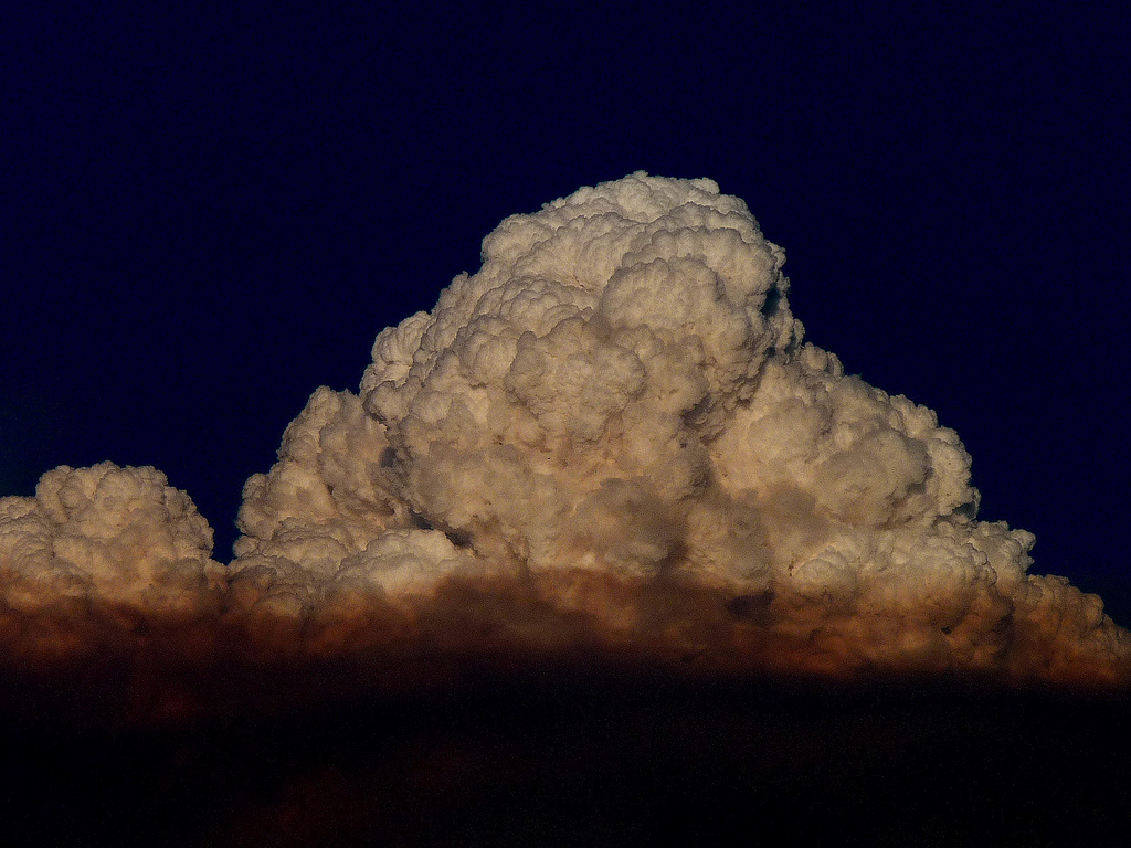
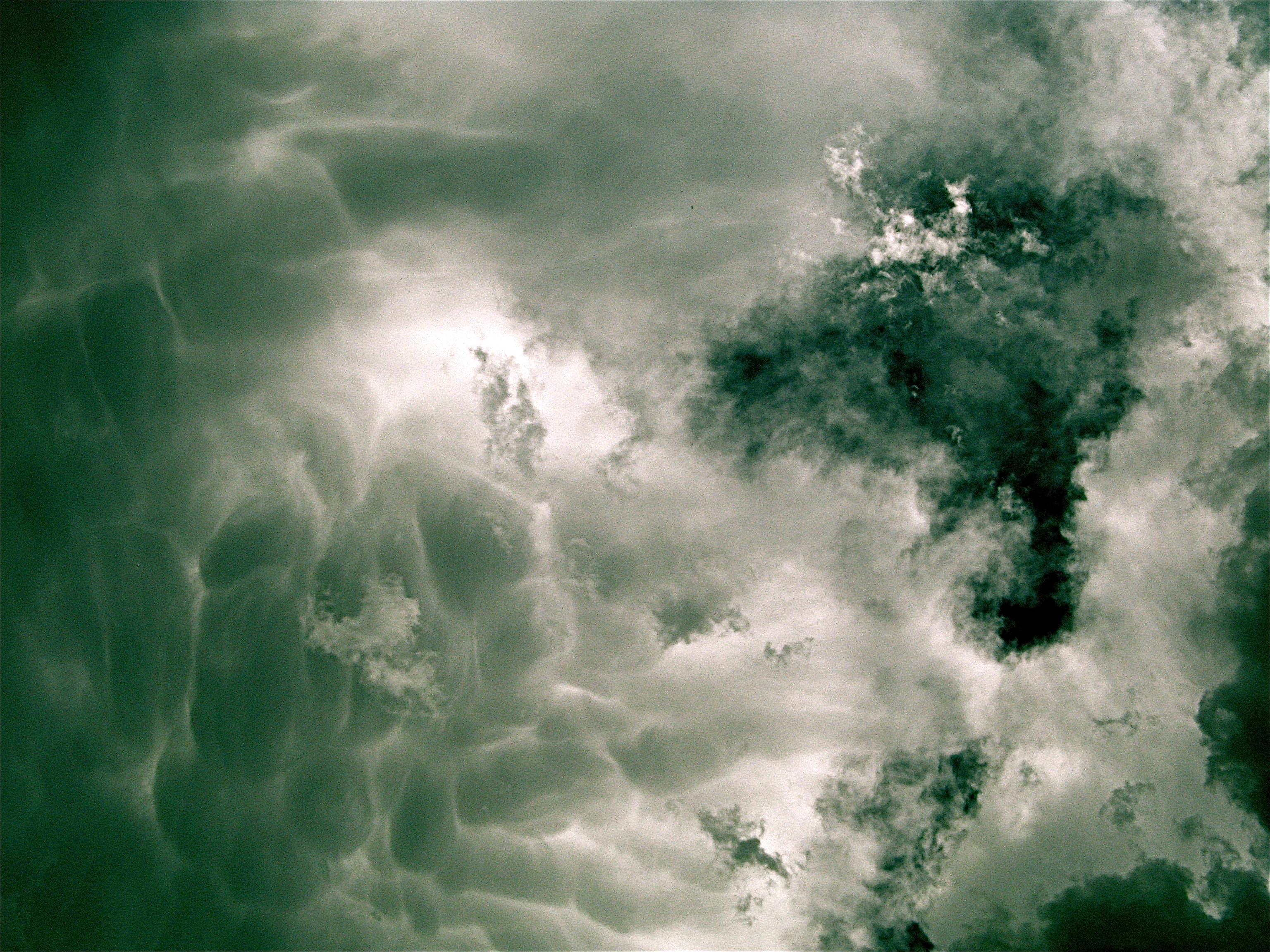
Lenticular Clouds

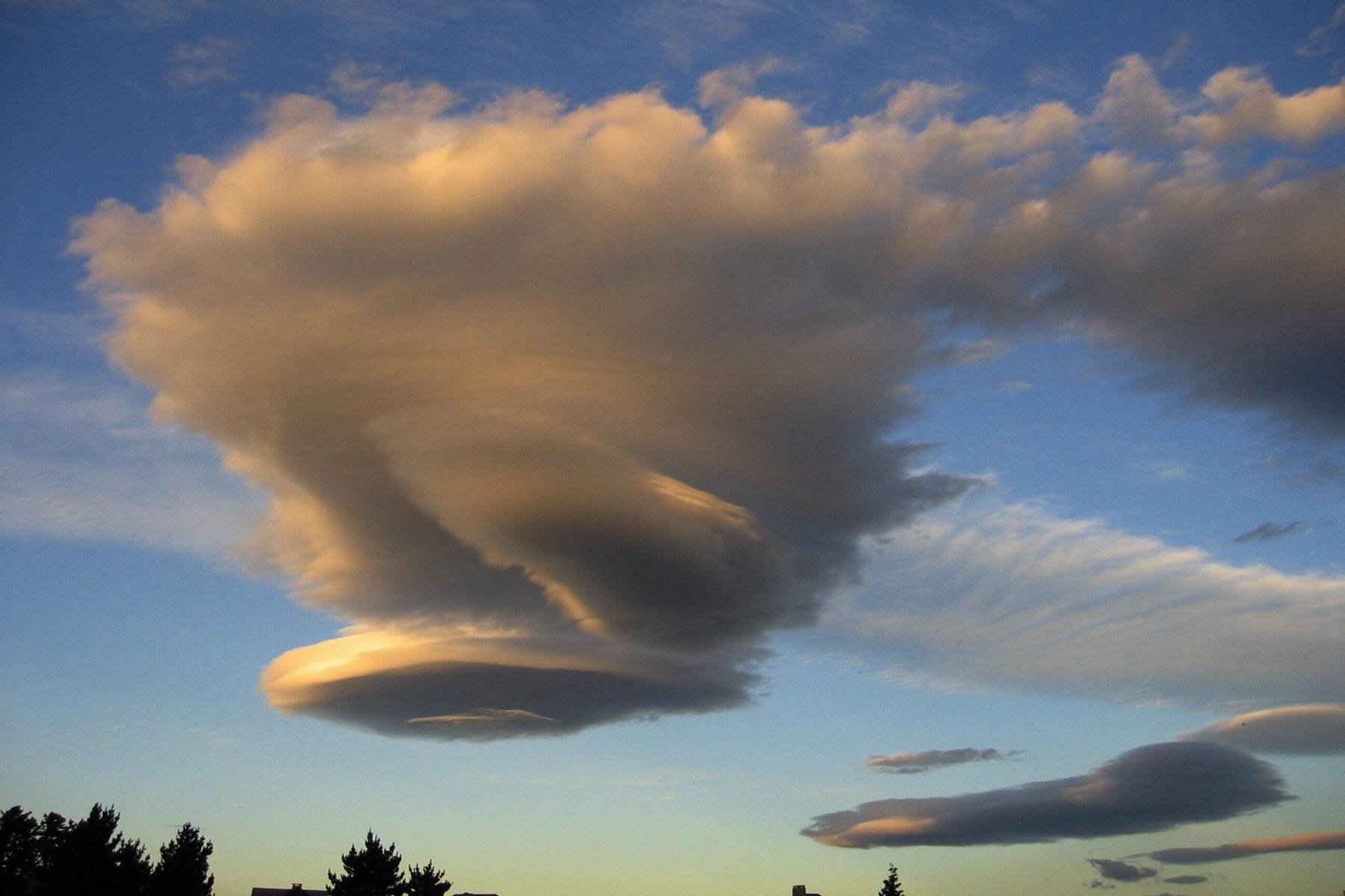
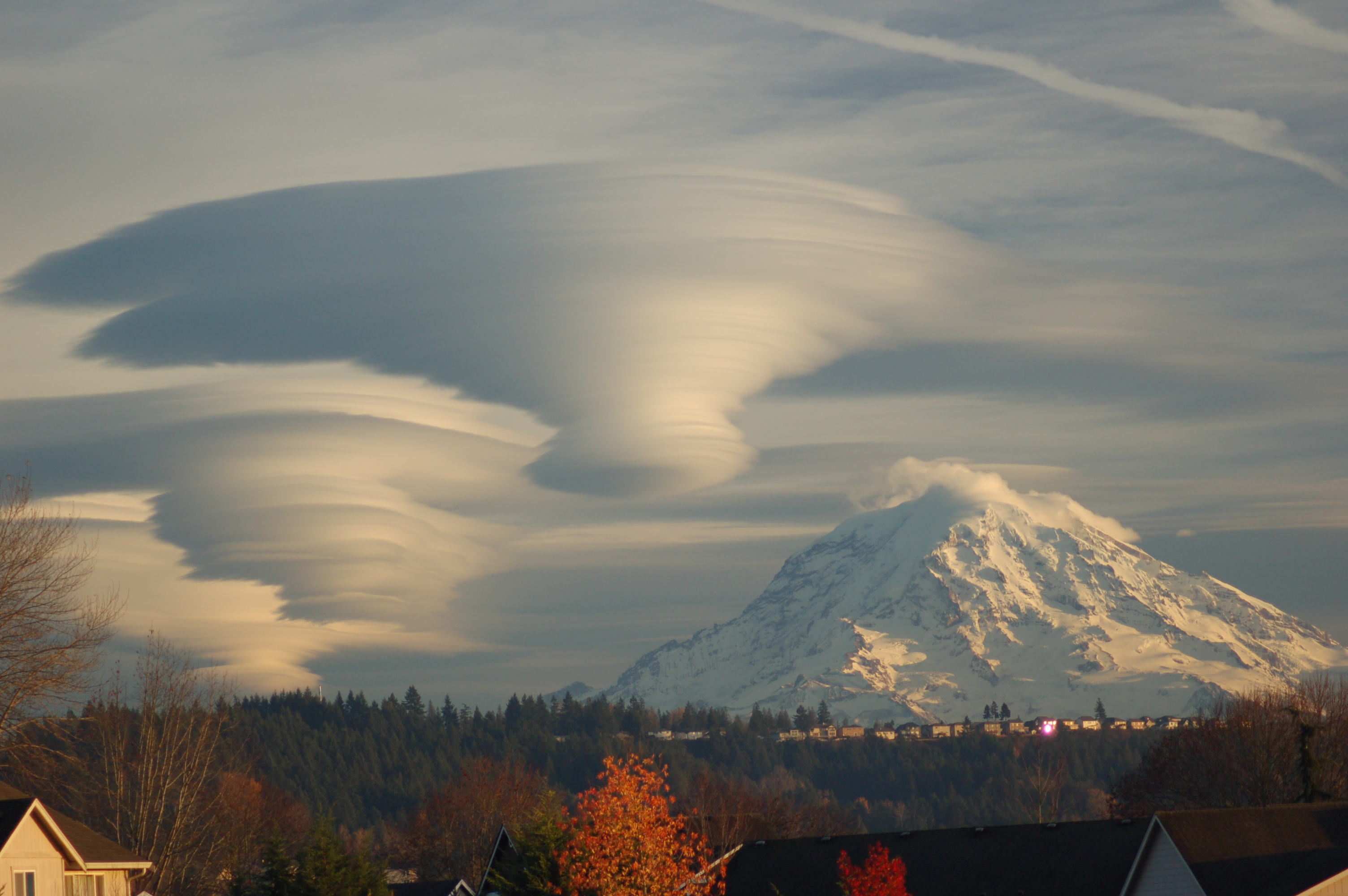
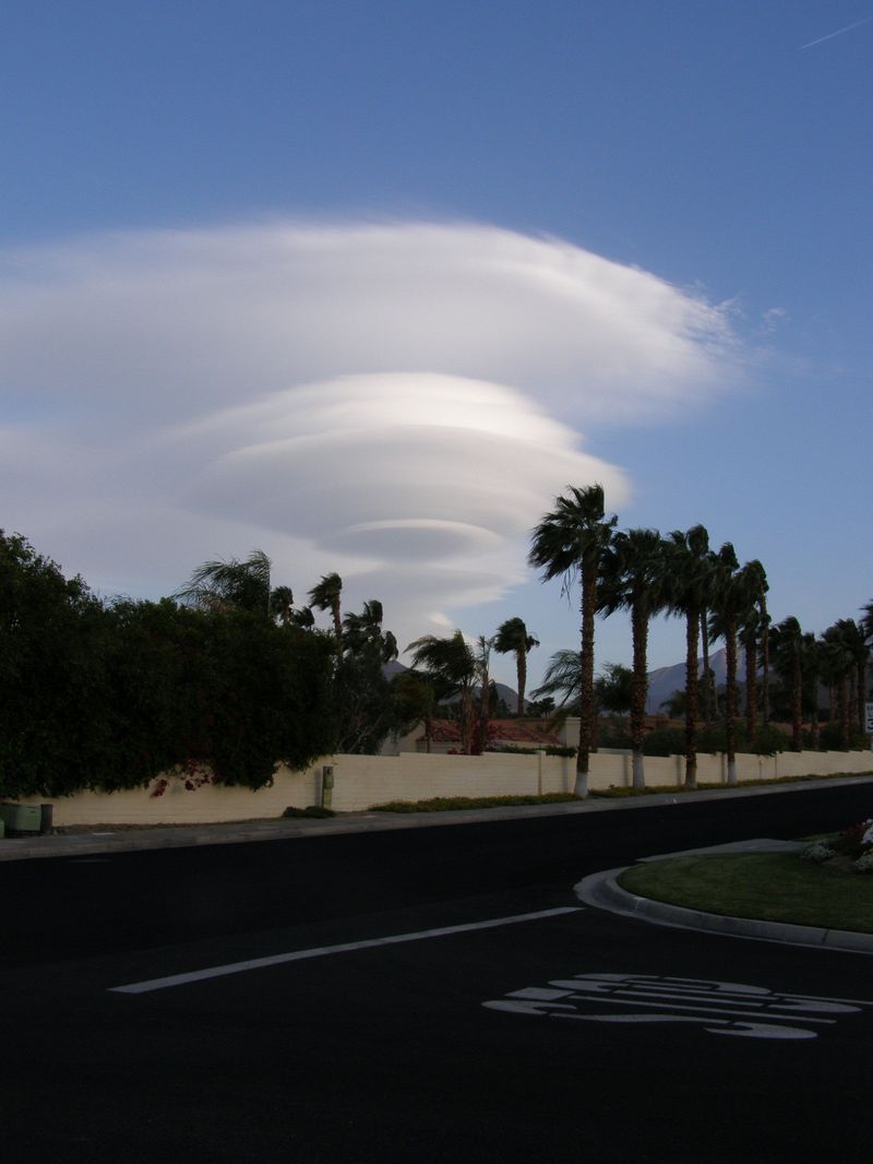
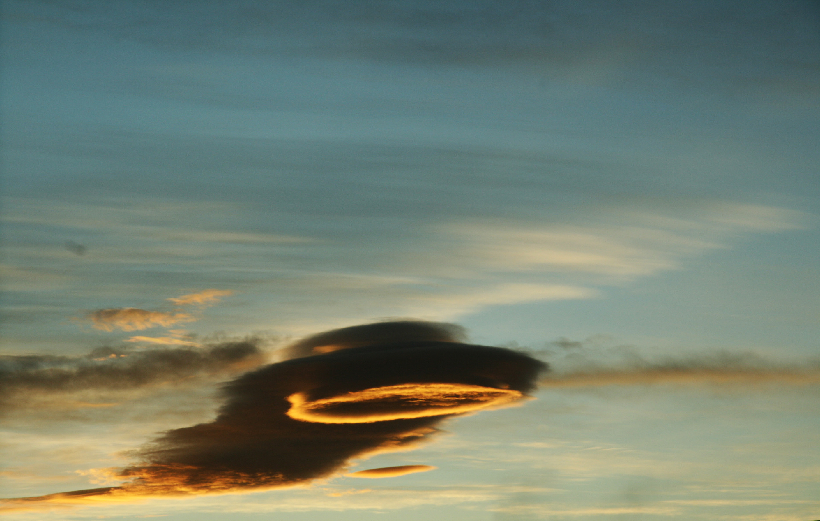
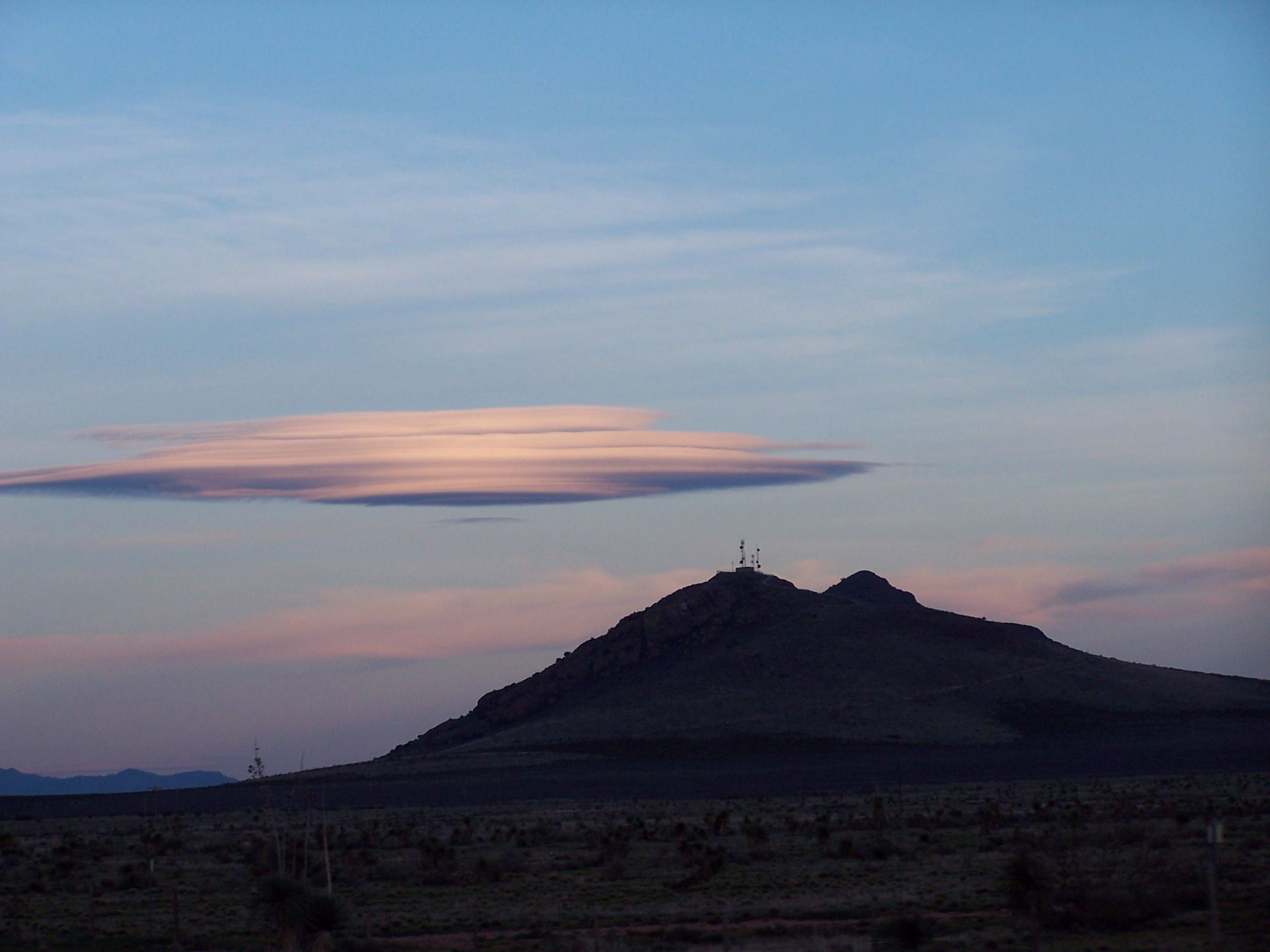
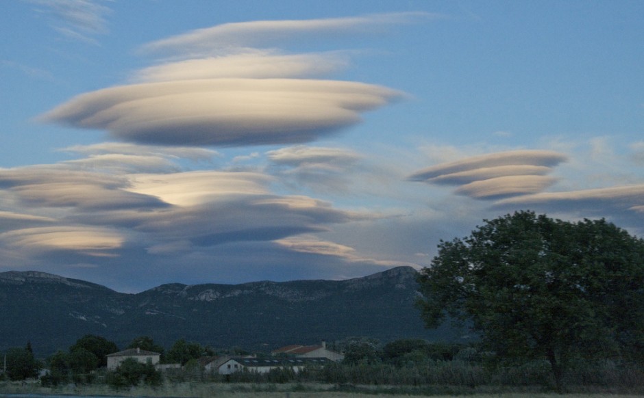
Lenticular clouds are lens-shaped clouds forming high in the atmosphere. Because of their very distinctive shape it is not uncommon for people to mistake them for UFOs – especially if they vanish quickly. They make especially grand displays when they form over a mountain top given the appearance of a halo. They usually appear at right angles to the prevailing wind direction. NOTE: the main photo above is apparently a photoshop – but as far as we can tell the rest are authentic.
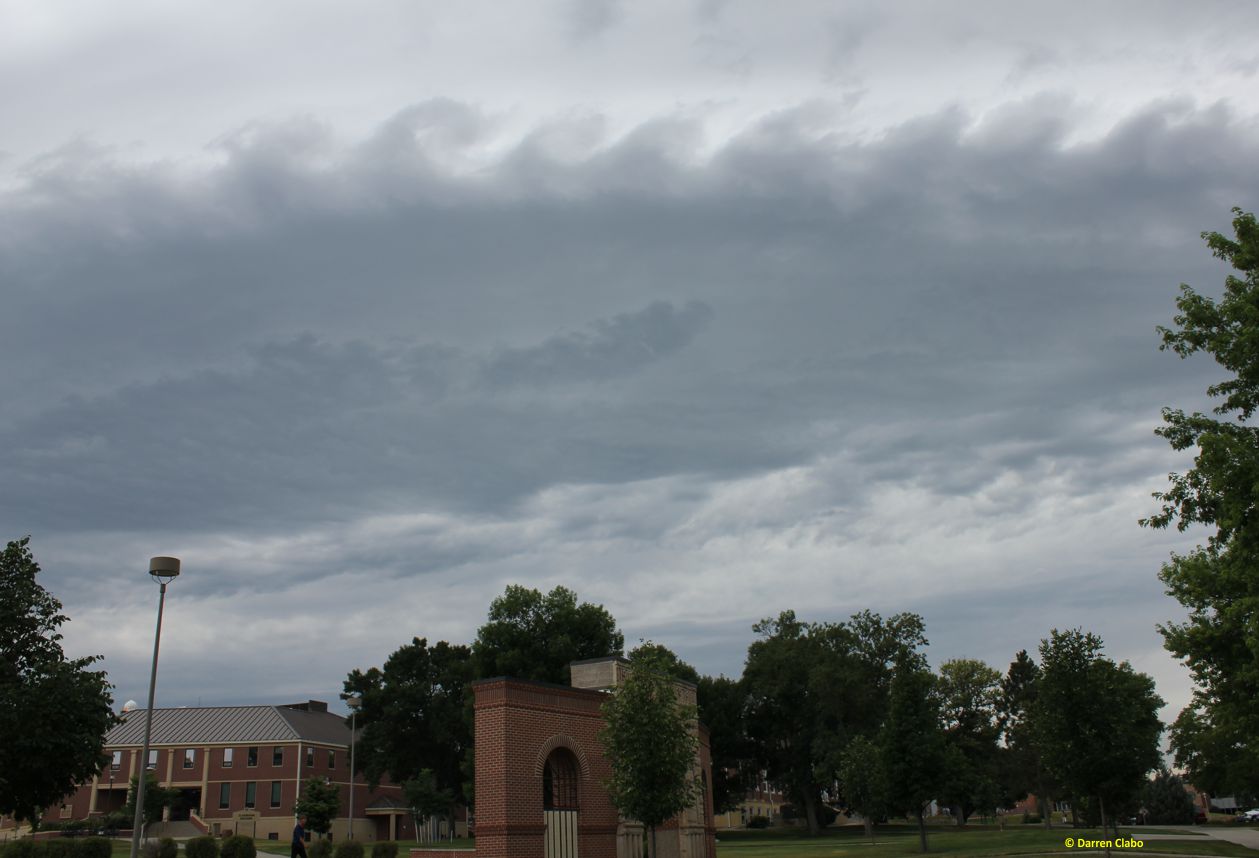
4
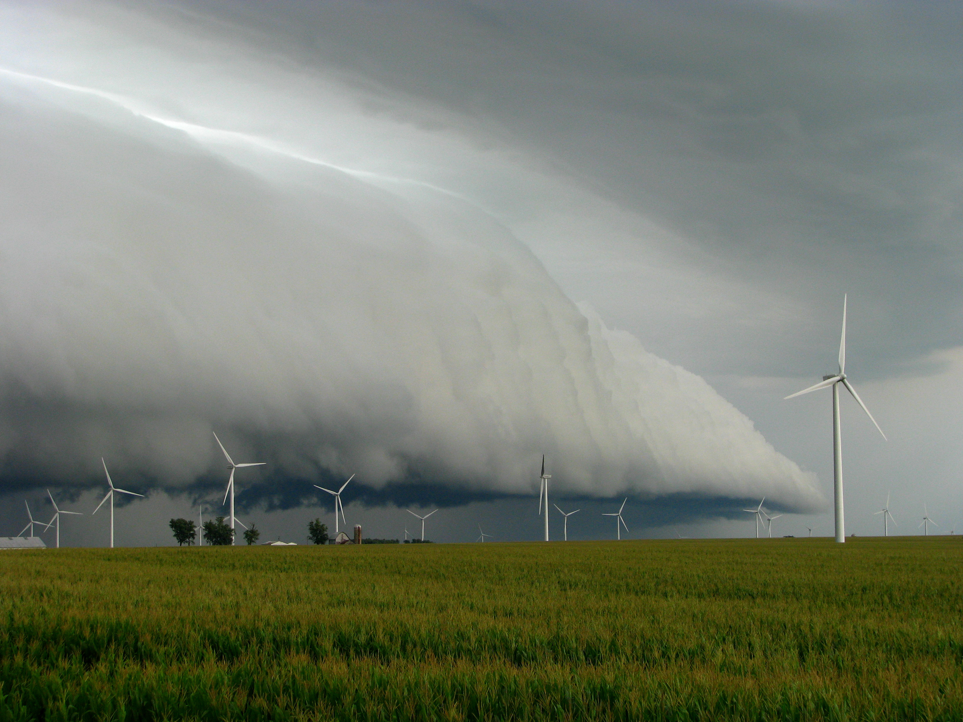
Roll Clouds


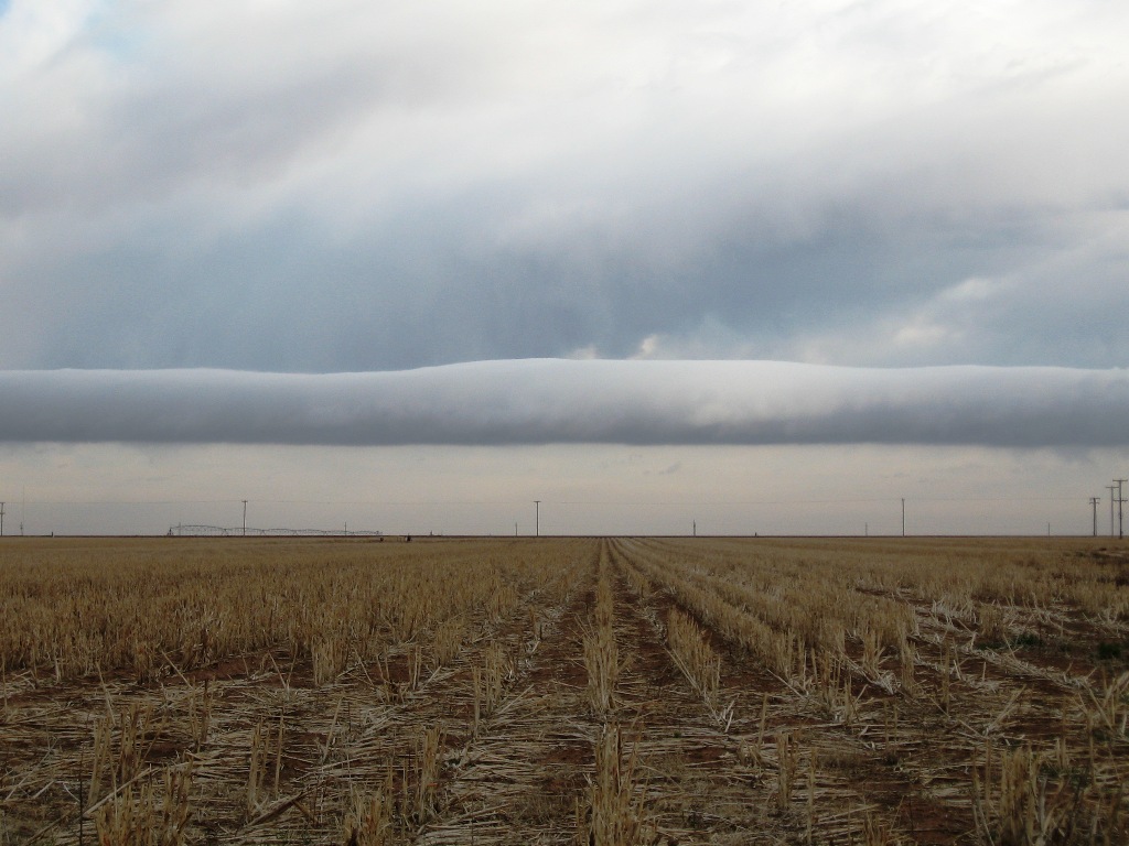

Roll clouds (also known as Arcus clouds) are probably the most frightening to behold. Fortunately if you want to see one of these clouds you can – they form quite frequently in Australia’s Gulf of Carpentaria. Despite its regular appearance in Australia, it is still not truly understood how these clouds are formed.
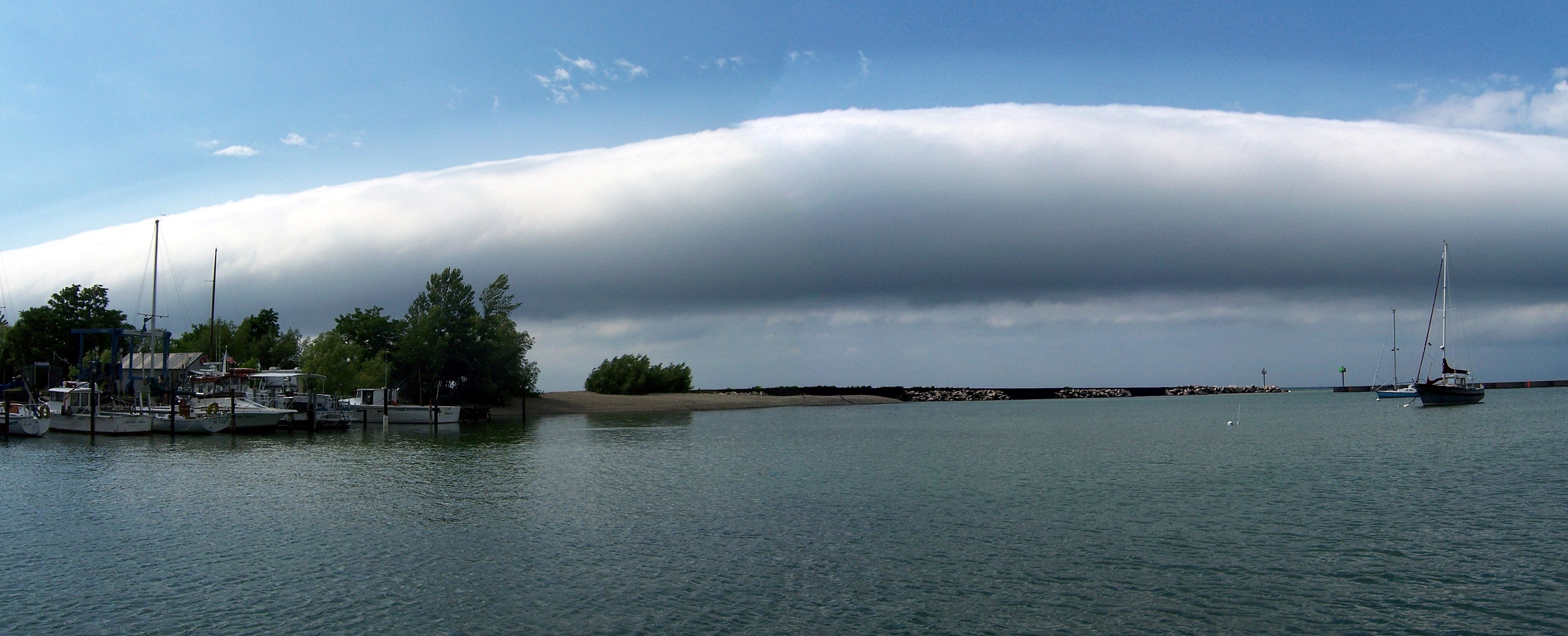
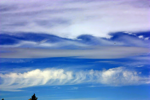
3
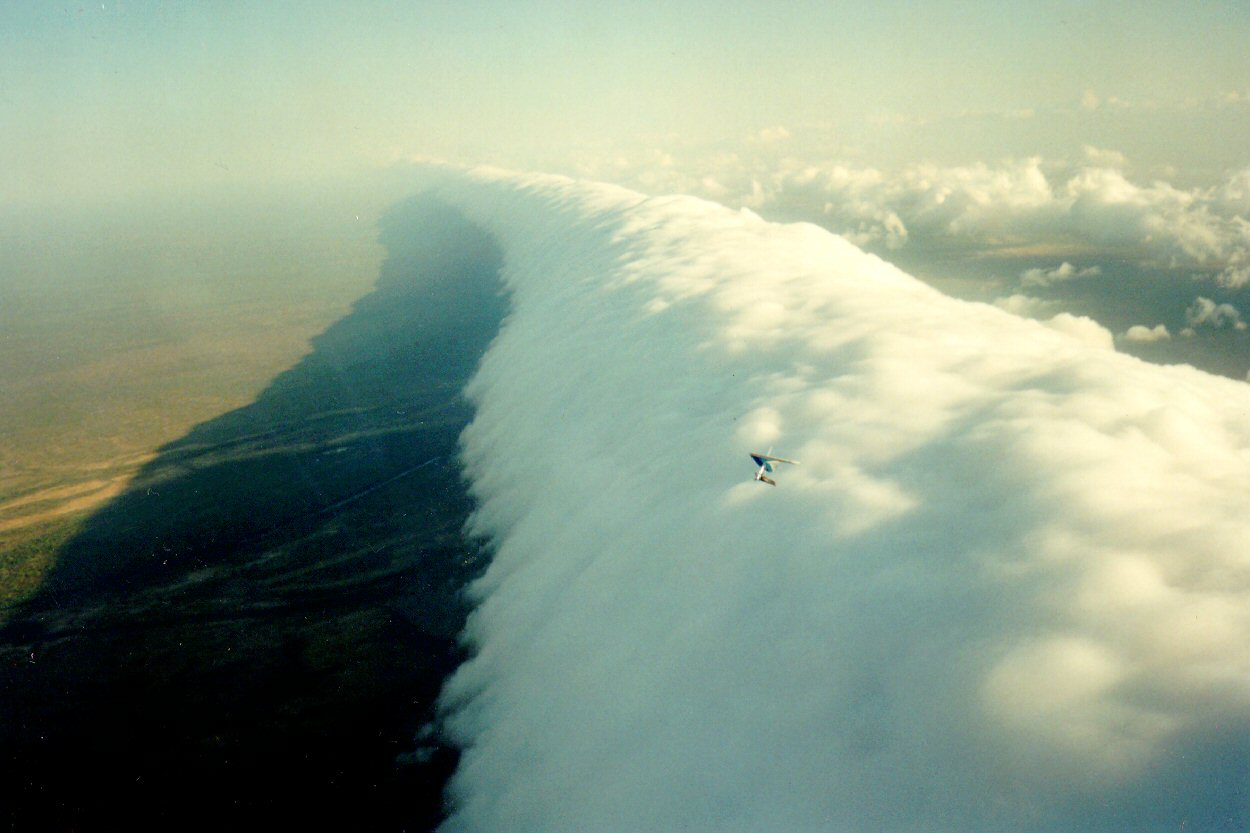
Shelf Clouds


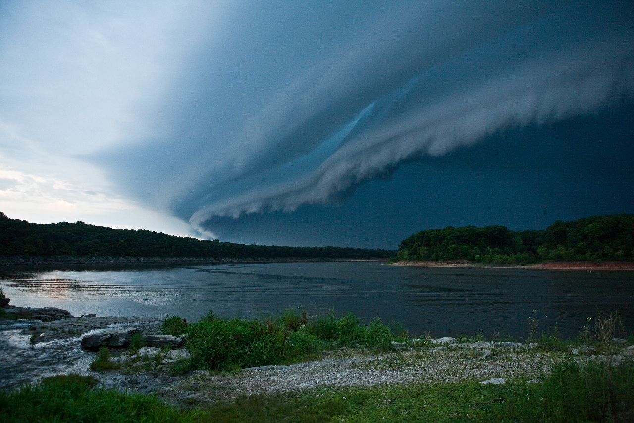
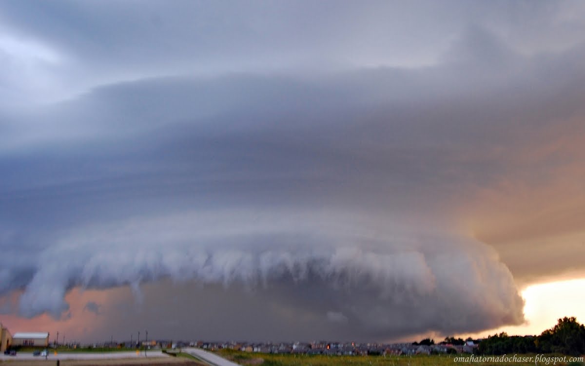
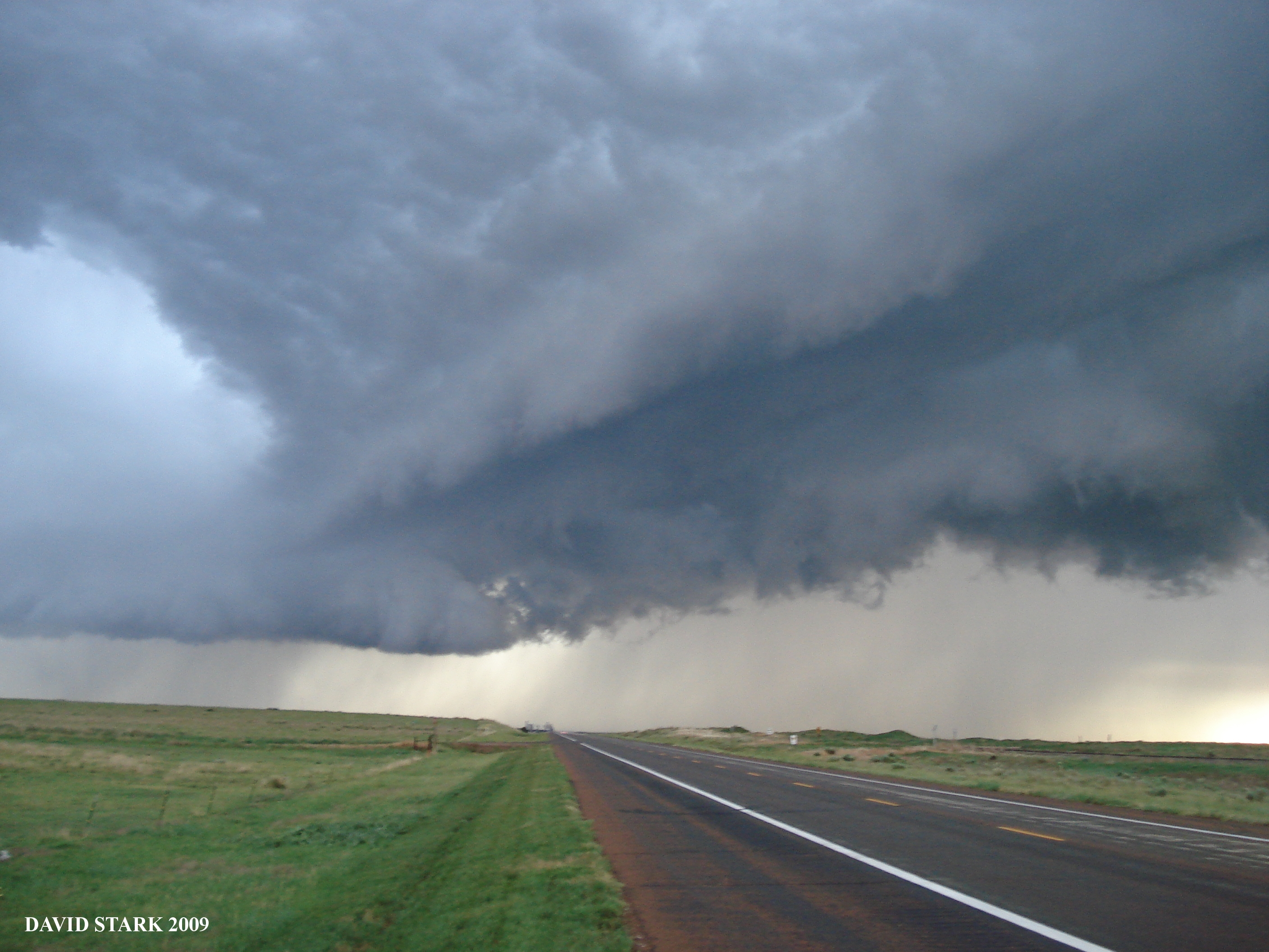
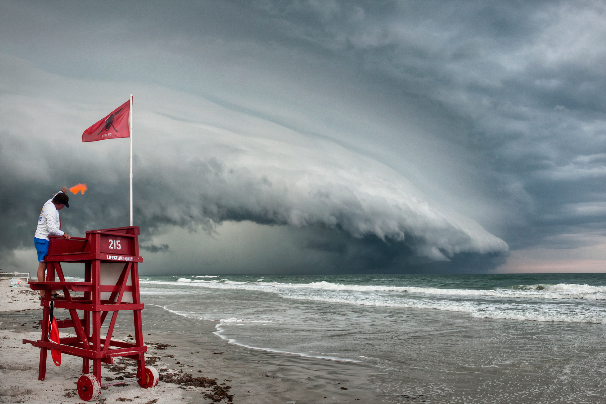
Unlike roll clouds, shelf clouds are attached to a larger parent cloud. But, like the roll cloud it, too, is an arcus cloud. They are often enormous and frequently forewarn the coming of a big storm, whereas roll clouds typically do not precede bad weather. Shelf clouds can falsely give the appearance of being a wall cloud (which comes after a storm) but a shelf cloud usually has a ragged bottom.
2
Kelvin-Helmholtz Clouds

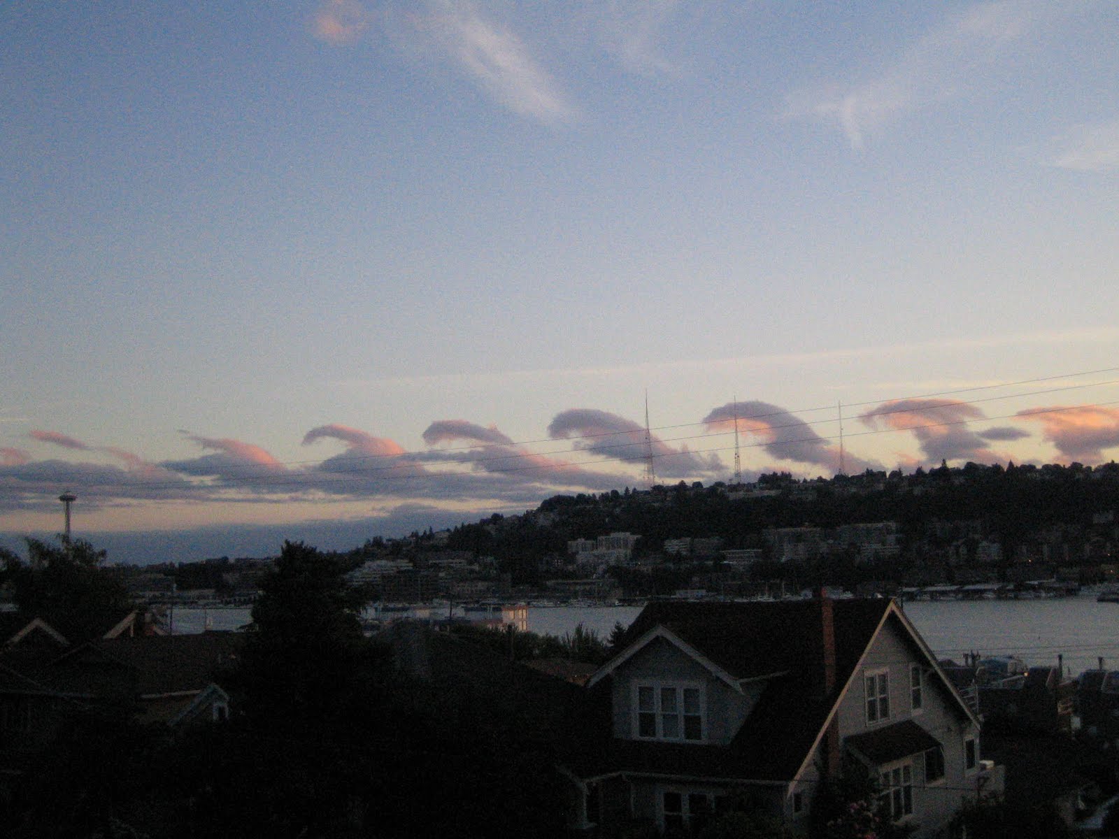
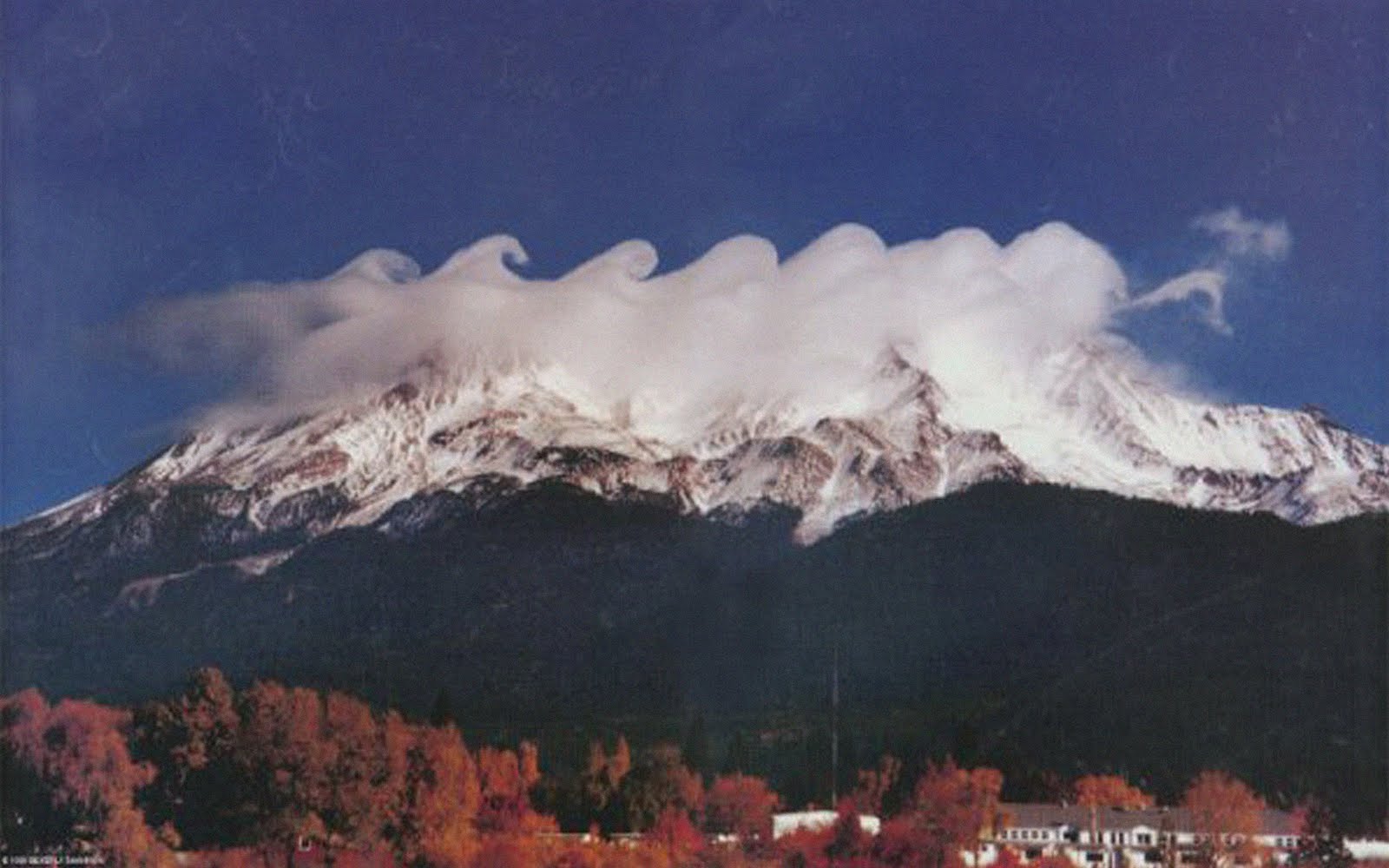
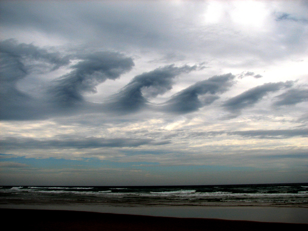
These are extremely rare clouds and when they do form they seldom last longer than a few minutes. They are formed by a Kelvin-Helmholtz instability which is when there is a velocity sheer over a continuous fluid (wow – that is complicated!) Interestingly it is this same effect which causes the curved ripples seen in the atmosphere of Saturn. There is no doubt that this is one of the most beautiful cloud formations of all.
1
Mammatus Clouds

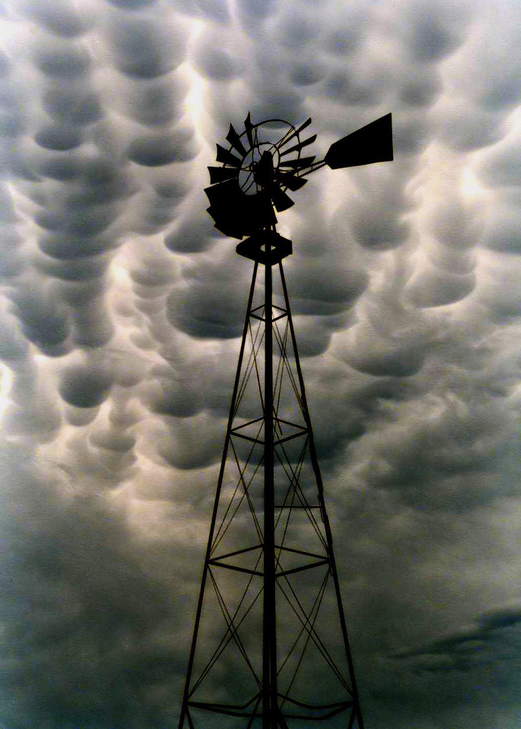
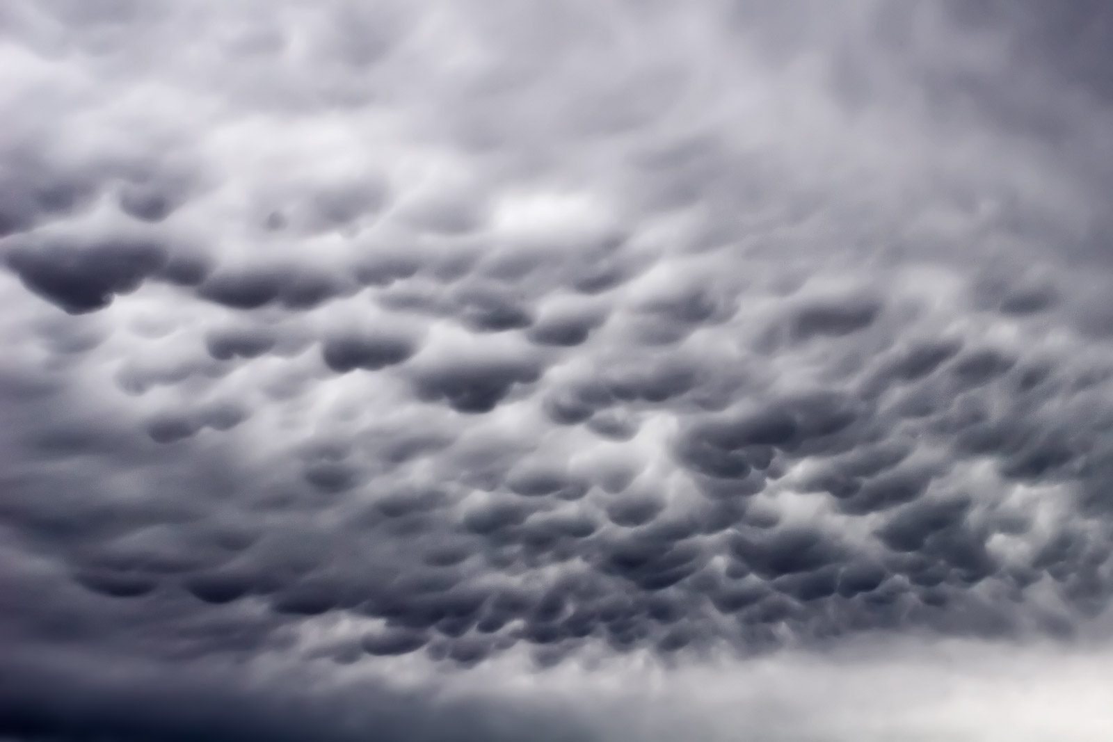
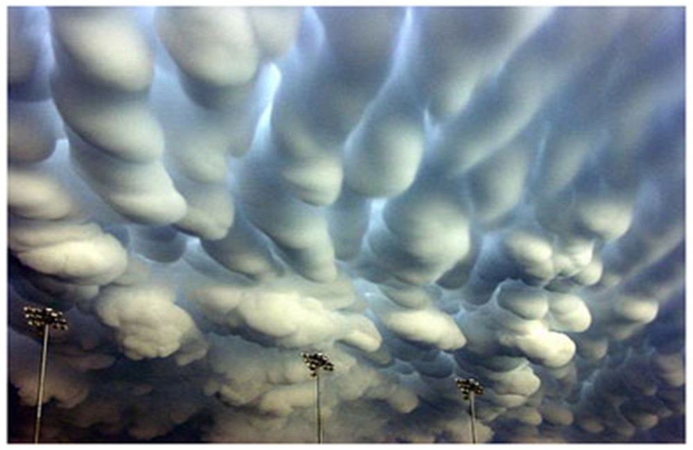
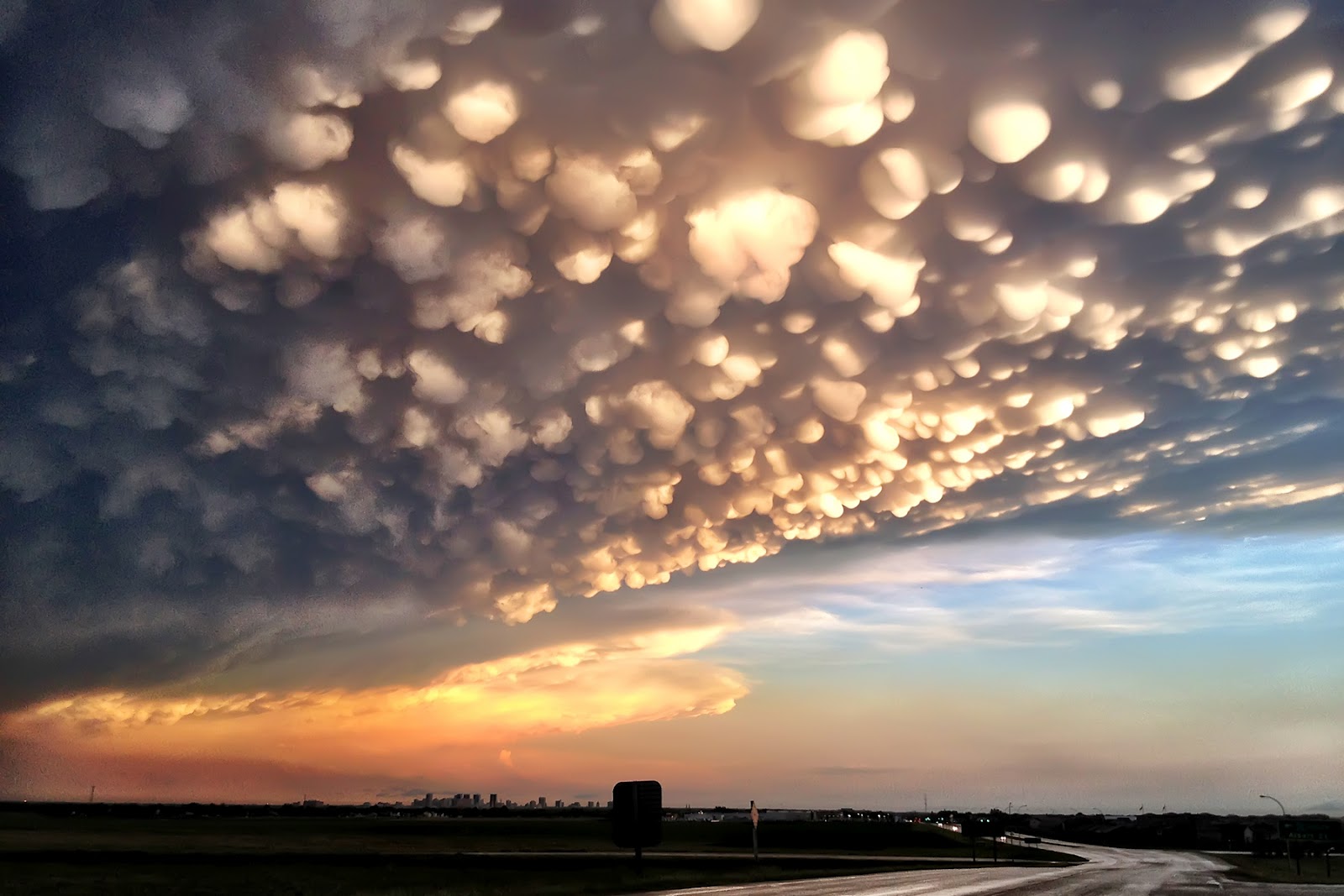
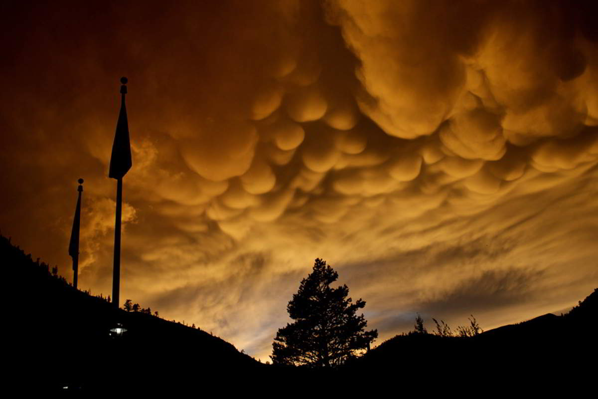
Like something from a Dr Seuss book, these clouds are named for what they look like: breasts. Immense pendulous bulbs dangle below the main body of these clouds to give them their very distinctive look. What is most amazing is that these clouds appear around the same time as severe weather is about to happen – so they are a good warning system. They can stretch for miles and can last for up to fifteen minutes. No one knows what causes these clouds as yet but many hypotheses exist.
More Great Lists
 10 Ancient Surfaces With Rare Images And Carvings
 10 First Images Of Rare Or Unique Things
 Top 10 Rare Archaeological Discoveries Involving Horses
 10 Fascinating Things Rare Fossils Recently Taught…
 10 Rare Finds Proving The Ocean Is A Weird Place
 Top 10 Rare And Quirky Finds From The Medical World
 10 Rare Old Medicines That Had Horrific Side Effects
 10 Rare Artifacts With Fascinating Backstories
 Top 10 Quirky And Rare Facts About Martian Geology
fact checked by
Jamie Frater
More Great Lists